![]()
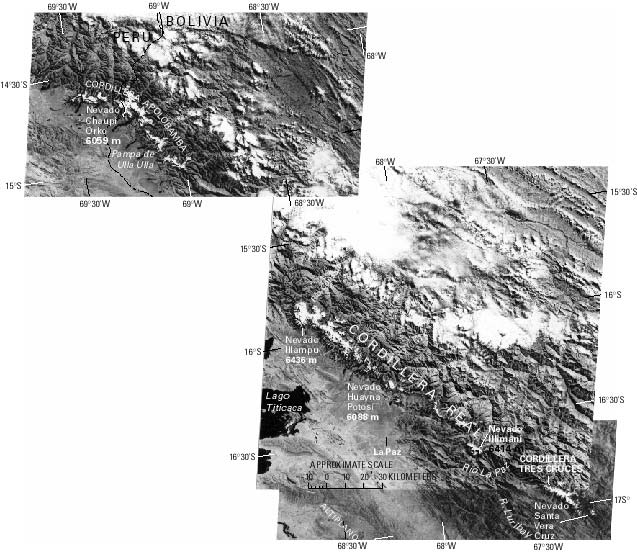
Figure 8.--Annotated Landsat 2 MSS image mosaic of glacierized regions of the Cordilleras Apolobamba, Real, Tres Cruces, and of Nevado Santa Vera Cruz of Bolivia. The satellite mosaic gives an excellent view of the geographical arrangement of the glaciers of the region. The images showing minimum snow cover were chosen. The white areas in the northeast corner of the mosaic are not snowfields, but clouds. The Landsat images, all from the EROS Data Center, Sioux Falls, S. Dak., from north to south are:
1. Landsat image 2187-13565, band 7; 28 July 1975; Path 1, Row 70
2. Landsat image 2168-13520, band 7; 9 July 1975; Path 251, Row 71
3. Landsat image 2276-13505, band 7; 25 October 1975; Path 251, Row 72
| Click the "Close" box to exit this window. |
U.S. Geological Survey, U.S.Department of the Interior