![]()
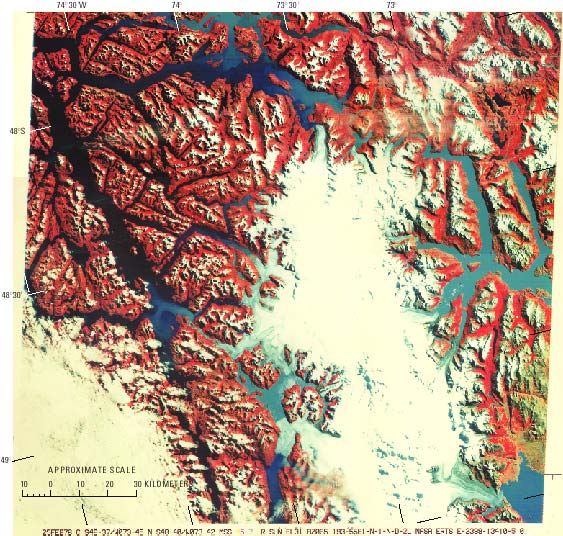
Figure 33.--Landsat 2 false-color composite image of the northern part of the Southern Patagonian Ice Field on 25 February 1976. (In the lower left-hand corner, obscured by clouds, is Isla Wellington.) See geographic place-names in map, figure 29, which shows the glacier termini as they were in 1946. Note that between 1946 and 1976, Glaciar O'Higgins receded about 11 km, whereas Glaciar Brüggen advanced 9 km. A 25-km-long lake formed be-tween Glaciar Brüggen and Glaciar Occidental. Glacier rock flour makes this lake and Lago O'Higgins appear light blue, as do the sediment plumes entering the fjords from glacial rivers or tidal glaciers. Note also that on most glaciers, the moraines and bands of tephra appear deep blue. Landsat image (2399-13410, bands 4, 5, and 7; 25 February 1976; Path 248, Row 94) is from the EROS Data Center, Sioux Falls, S. Dak.
| Click the "Close" box to exit this window. |
U.S. Geological Survey, U.S.Department of the Interior