![]()
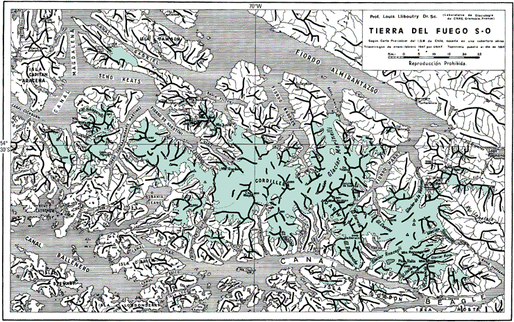
Figure 40.--Southwestern Tierra del Fuego. Taken from Lliboutry (1956). In this area are the southernmost Andes, which are heavily glacierized (shown in green) between Seno Almirantazgo [Fiordo Almirantazgo] and the Beagle Channel [Canal Beagle]. Very little glaciological work has been done there because of logistical difficulties. The access is by ship from Punta Arenas (fig. 1), and the area is not inhabited. The Andes continue eastward but have only local glaciers in Argentine territory. The access in the east is from the town of Ushuaia on the Beagle Channel (fig. 1). The thick lines are ridgelines. Some geographic place-names are inconsistent with those used in the text, and those in the text conform to the usage recommended by the U.S. Board on Geographic Names in the gazetteers of Argentina (1992a) and Chile (1967, 1992b).
| Click the "Close" box to exit this window. |
U.S. Geological Survey, U.S.Department of the Interior