![]()
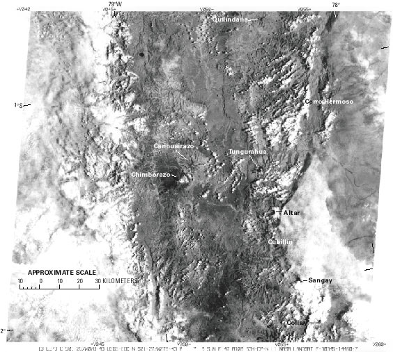
Figure 10.--Landsat 3 MSS image of the southern part of the Ecuadorean Andes (see location in fig. 1) showing the area of the glacierized volcanoes and two nonvolcanic mountains discussed in the text; none of the other peaks support glaciers. The cloud cover extends into the Andean area and obscures glacier identification. The glacier peaks in the southeast, Altar, Cubillín, Sangay, and Collay are partially or completely hidden. Cubillín and Collay cannot be recognized at all. Cerro Ayapungo is located south of the image. Landsat image (30345-14460, band 7; 13 February 1979; Path 10, Row 61) from the EROS Data Center, Sioux Falls, S. Dak.
| Click the "Close" box to exit this window. |
U.S. Geological Survey, U.S.Department of the Interior