![]()
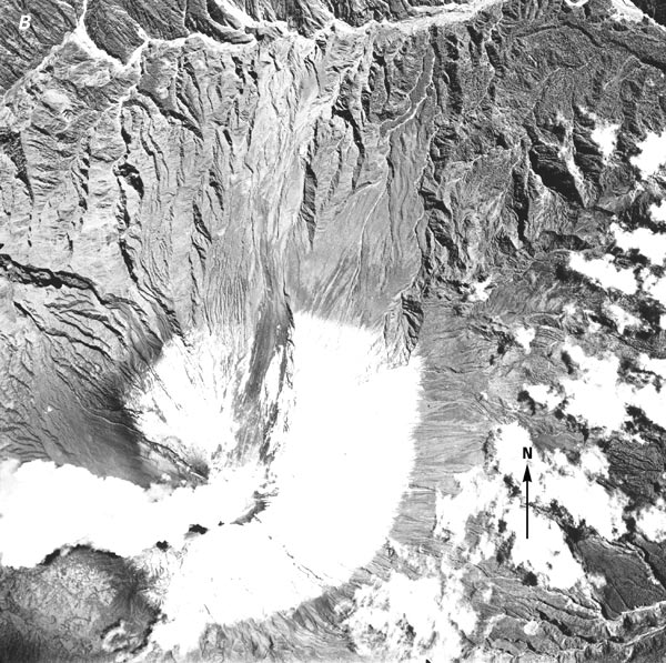
B, A vertical aerial photograph shows the partially destroyed snow cover. Photograph acquired 13 June 1956 by HYCON, M-172, no. 29671, from an elevation of approximately 8,500 m. The scale is approximately 1:50,000. Photograph from the Instituto Geográfico Militar, Quito, Ecuador, and released by Order No. 326, dated 7 July 1980.
| Click the "Close" box to exit this window. |
U.S. Geological Survey, U.S.Department of the Interior