![]()
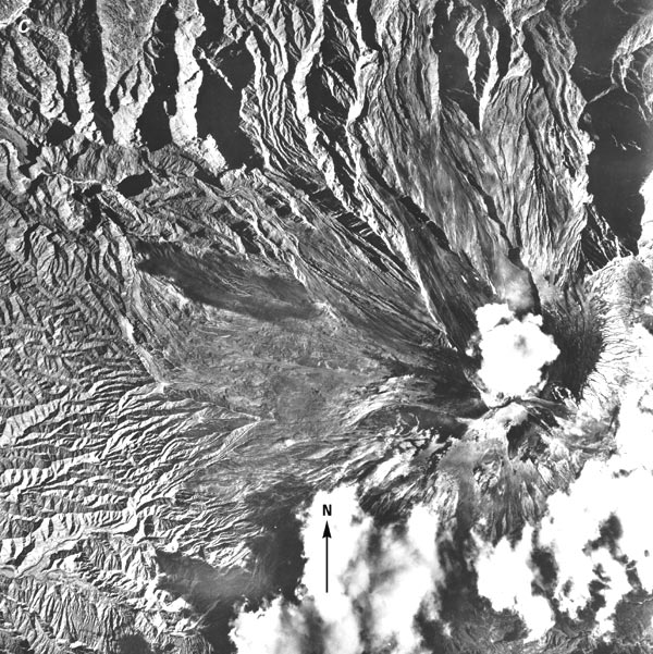
C, A vertical aerial photograph shows the predominantly snow-and-ice free summit region. Photograph acquired on 8 February 1965 by the U.S. Air Force, AF 60-16, R-77, no. 6894, from an elevation of approximately 8,500 m. The scale is approximately 1:60,000. Photograph from the Instituto Geográfico Militar, Quito, Ecuador, and released by Order No. 326, dated 7 July 1980.
| Click the "Close" box to exit this window. |
U.S. Geological Survey, U.S.Department of the Interior