![]()
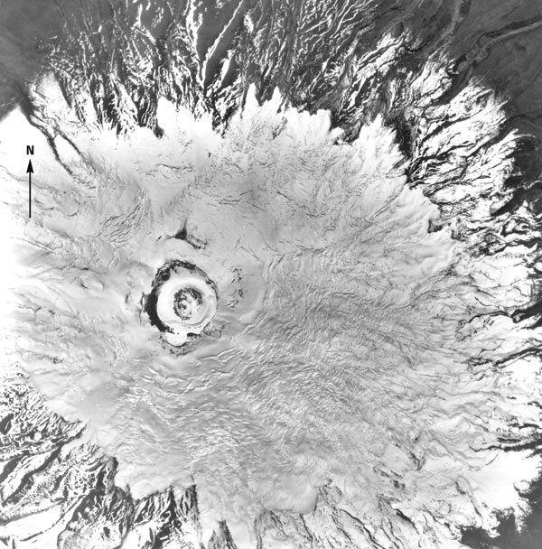
Figure 8.--Vertical aerial photograph of Cotopaxi showing the crater area and most of the summit ice cap. The photograph was taken earlier than figures 6 and 7, and the ice-free areas caused by geothermal activity are not visible. A recent snowfall also masks the "ash cover" below the glacierized area. Photograph number PI0-69-22b was acquired on 22 June 1963 and is from U.S. Geological Survey photograph collection. The approximate scale is 1:30,000.
| Click the "Close" box to exit this window. |
U.S. Geological Survey, U.S.Department of the Interior