![]()
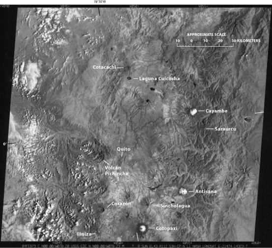
Figure 9.--Landsat 2 MSS image of the northern part of the Ecuadorean Andes (see location in fig. 1) showing the glacierized volcanoes discussed in the text. Some peaks are free of glaciers but show evidence of Pleistocene glaciation. Landsat image (21474-14323, band 7; 4 February 1979; Path 10, Row 60) from the EROS Data Center, Sioux Falls, S. Dak.
| Click the "Close" box to exit this window. |
U.S. Geological Survey, U.S.Department of the Interior