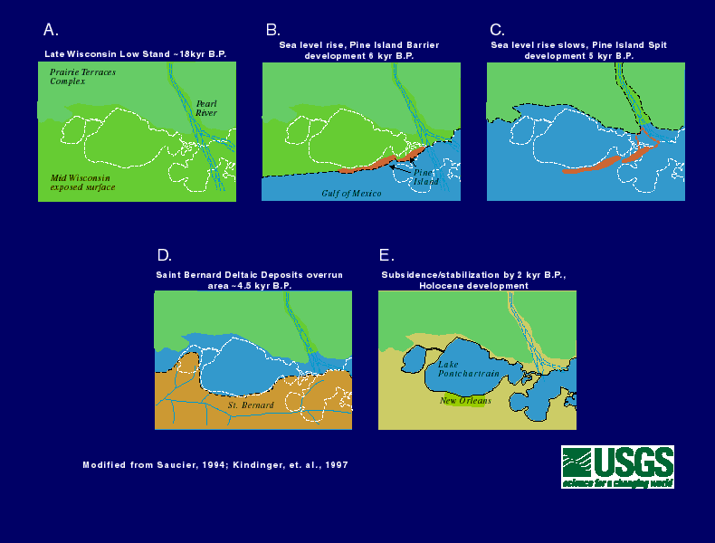
Figure 9. Schematic representation during the formation of Lake Pontchartrain as sea-level rose. (A) The Louisiana area was emergent during the late Wisconsinan lowstand, ~18k yr B.P. (B) As sea-level rise neared present levels, the Pine Island Barrier developed, ~6k yr B.P. (C) Sea-level rise slows, and a relatively short stillstand initiates development of the Pine Island Spit forming the Pontchartrain Embayment, ~5k yrs B.P. (D) A subdelta of the Mississippi River, the St. Bernard, progrades across the area (E) forming Lake Pontchartrain and associated lakes. |
Back to Geologic Framework |
Back to Geologic History