 |
| Professional Paper 1643: FIGURE 1 |
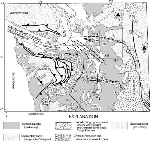
Schematic geology of northwestern Washington and southwestern British Columbia showing Puget Lowland and flanking Cascade Range and Olympic Mountains, and southern Vancouver Island. B, Bellingham; E, Everett; O, Olympia; S, Seattle; T, Tacoma; V, Victoria. Heavy line, fault; dashed where inferred, sawteeth on upper plae of thrust fault. Triangle, modern Cascade volcano. Abbreviations for faults (heavy lines), modern Cascade volcanoes (triangles) and other features: DAF, Darrington fault; DMF, Devils Mountain fault; EB, Everett basin; GP, Glacier Peak; HC, Hood Canal; LC, Lake Cavanaugh; LRF, Leech River fault; MB, Mount Baker; SB, Seattle basin; SCF, Straight Creek fault; SF, Seattle fault; SJ, San Juan Islands; SJF, San Juan fault; SWF, southern Whidbey Island fault. Geology from maps and compilations of Tabor and Cady (1978), Washington Public Power Supply System (1981), Gower and others (1985), Walsh and others (1987), Tabor and others (1988, 1993), Whetten and others (1988), Yount and Gower (1991), Tabor (1994), Johnson and others (1996, 1999, 2001).
Use BACK button to return
Contact: Susan Rhea
This page is brought to you by the Earthquake Hazards Program
