|
| Professional Paper 1643: FIGURE 3 |
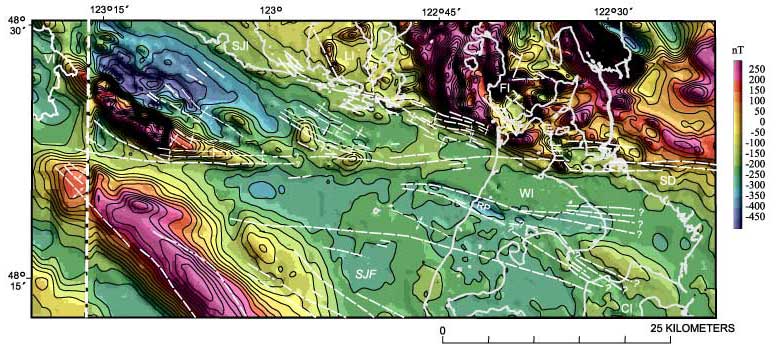
Figure 3
Shaded relief map of the aeromagnetic anomaly map, eastern Strait of Juan de Fuca-northern Puget Lowland region (figure 1). Illumination is from the northeast. Heavy white lines, coastlines. Light white lines, faults and folds of figure 2. Vertical white line on west part of diagram, boundary between two different magnetic surveys. CI, Camano Island; FI, Fidalgo Island; LI, Lopez Island; SJF, Strait of Juan de Fuca; SD, Skagit River delta; SJI, San Juan Island; VI, Vancouver Island; WI, Whidbey Island
Use BACK button to return
Contact: Susan Rhea
This page is brought to you by the Earthquake Hazards Program