 |
| Professional Paper 1643: FIGURE 38 |
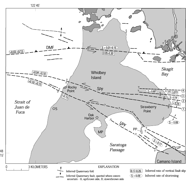
Figure 38
Northern Whidbey Island area showing locations of faults and folds that deform Quaternary deposits, inferred rate (commonly a minimum) of vertical fault-slip (mm/yr), and shortening rates on the Devils Mountain fault (DMF), Strawberry Point fault (SPF) and Utsalady Point fault (UPF). Queried rates are based on meager data and are highly speculative, and each fault probably has a significant component of lateral slip for which slip-rate information is not available. Dark-shaded areas are underlain by pre-Quaternary bedrock (figure 6). Light-shaded areas are underlain by Quaternary deposits. MP, Maylor Point; PP, Polnell Point; S, Swantown; UP, Utsalady Point.
Use BACK button to return
Contact: Susan Rhea
This page is brought to you by the Earthquake Hazards Program
