 |
| Professional Paper 1643: FIGURE 4 |
Figure 4
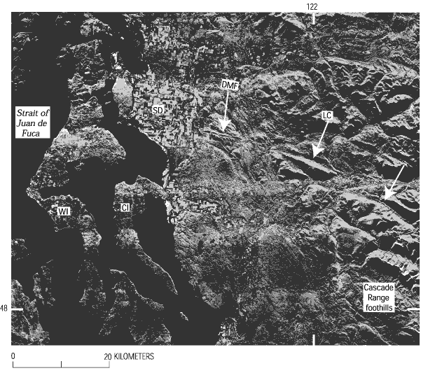
SLAR (side-looking airborne radar) image of portion of northwestern Washington (figure 1). White arrows show topographic lineament associated with Devils Mountain fault. Middle arrow also shows location of elongate Lake Cavanaugh (LC), which occurs along the lineament. CI, Camano Island; DMF, Devils Mountain fault; SJF, Strait of Juan de Fuca; SD, Skagit River delta; WI, Whidbey Island. Area of image shown in figure 1.
Use BACK button to return
Contact: Susan Rhea
This page is brought to you by the Earthquake Hazards Program
