 |
|
|
||||
| Professional Paper 1643: FIGURE 5 |
| About USGS / Science Topics / Maps, Products & Publications / Education / FAQ |
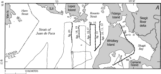
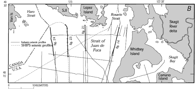
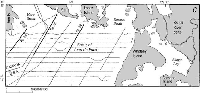
Locations of tracklines in eastern Strait of Juan de Fuca for A, 1995 U.S. Geological Survey high-resolution, seismic-reflection survey; B industry, SHIPS (Fisher and others, 1999), and Puget Power (1979) conventional seismic-reflection surveys; and C, 1996 Geological Survey of Canada high-resolution, seismic-reflection survey. Labeled and highlighted lines and line segments are shown in figs. 8-26. Ticks on labeled tracklines correspond to shotpoints plotted on profiles. SJI, San Juan Island; Van Is, Vancouver Island.
Use BACK button to return
| AccessibilityFOIAPrivacyPolicies and Notices | |
| |
|