Ground-Water Resources Program; National Research Program
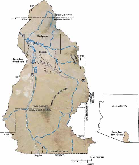
Location of study area, Pima County, Arizona (from figure 1).
Abstract
A large fraction of ground water stored in the alluvial aquifers in the Southwest is recharged by water that percolates through ephemeral stream-channel deposits. The amount of water currently recharging many of these aquifers is insufficient to meet current and future demands. Improving the understanding of streambed infiltration and the subsequent redistribution of water within the unsaturated zone is fundamental to quantifying and forming an accurate description of streambed recharge. In addition, improved estimates of recharge from ephemeral-stream channels will reduce uncertainties in water-budget components used in current ground-water models.
This chapter presents a summary of findings related to a focused recharge investigation along Rillito Creek in Tucson, Arizona. A variety of approaches used to estimate infiltration, percolation, and recharge fluxes are presented that provide a wide range of temporal- and spatial-scale measurements of recharge beneath Rillito Creek. The approaches discussed include analyses of (1) cores and cuttings for hydraulic and textural properties, (2) environmental tracers from the water extracted from the cores and cuttings, (3) seepage measurements made during sustained streamflow, (4) heat as a tracer and numerical simulations of the movement of heat through the streambed sediments, (5) water-content variations, (6) water-level responses to streamflow in piezometers within the stream channel, and (7) gravity changes in response to recharge events. Hydraulic properties of the materials underlying Rillito Creek were used to estimate long-term potential recharge rates. Seepage measurements and analyses of temperature and water content were used to estimate infiltration rates, and environmental tracers were used to estimate percolation rates through the thick unsaturated zone. The presence or lack of tritium in the water was used to determine whether or not water in the unsaturated zone infiltrated within the past 40 years. Analysis of water-level and temporal-gravity data were used to estimate recharge volumes. Data presented in this chapter were collected from 1999 though 2002. Precipitation and streamflow during this period were less than the long-term average; however, two periods of significant streamflow resulted in recharge—one in the summer of 1999 and the other in the fall/winter of 2000.
Flux estimates of infiltration and recharge vary from less than 0.1 to 1.0 cubic meter per second per kilometer of streamflow. Recharge-flux estimates are larger than infiltration estimates. Larger recharge fluxes than infiltration fluxes are explained by the scale of measurements. Methods used to estimate recharge rates incorporate the largest volumetric and temporal scales and are likely to have fluxes from other nearby sources, such as unmeasured tributaries, whereas the methods used to estimate infiltration incorporate the smallest scales, reflecting infiltration rates at individual measurement sites.
download this report as a 36-page PDF file (pp1703h.pdf; 7.5 MB).
For questions about the content of this report, contact John Hoffmann
Suggested citation and version history
Back to Ground-Water Recharge in the Arid and Semiarid Southwestern United States
Download a free copy of the current version of Adobe Reader.
| Help
| PDF help
| Western reports main page | Western Professional Papers |
| Water Resources
| National Research Program
| Ground-Water Resources Program |
This report is available only on the Web

![]() U.S. Department of the Interior | U.S. Geological Survey
U.S. Department of the Interior | U.S. Geological Survey
URL: https://pubs.usgs.gov/pp/pp1703/h/
Page Contact Information: Michael Diggles
Page Last Modified: April 29, 2008