

The Saint Helens 7.5' quadrangle is situated in the Puget-Willamette Lowland approximately 35 km north Portland, Oregon. The lowland, which extends from Puget Sound into west-central Oregon, is a complex structural and topographic trough that lies between the Coast Range and the Cascade Range. Since late Eocene time, Cascade Range has been the locus of a discontinuously active volcanic arc associated with underthrusting of The Saint Helens quadrangle lies in the northern part of the Portland Basin, a roughly 2000-km2 topographic and structural depression. It is the northernmost of several sediment-filled structural basins that The Portland Basin has been interpreted as a pull-apart basin located in the releasing stepover between two echelon, northwest-striking, right-lateral fault zones (Beeson and others, 1985, 1989; Beeson and Tolan, 1990; Yelin and Patton, 1991; Blakely and others, 1995). These fault zones are thought to reflect regional transpression and dextral shear within the forearc in response to oblique subduction along the Cascadia Subduction Zone Pezzopane and Weldon, 1993; Wells and others, 1998). The southwestern margin of the Portland Basin is a well-defined topographic break along the base of the Tualatin Mountains, an asymmetric anticlinal ridge that is bounded its northeast flank by the Portland Hills Fault Zone (Balsillie and Benson, 1971; Beeson and others, 1989; Blakely and others, 1995), which is probably an active structure (Wong and others, 2001; Liberty and others, 2003). The nature of the corresponding northeastern margin of the basin is less clear, but a poorly defined and partially buried dextral extensional fault zone has been hypothesized from topography, microseismicity, potential fieldanomalies, and reconnaissance geologic mapping (Beeson and others, 1989; Beeson and Tolan, 1990; Yelin and Patton, 1991; Blakely and others, 1995). Another dextral structure, the Kalama Structural Zone of Evarts (2002), may underlie the north-northwest-trending reach of the Columbia River north of Woodland (Blakely and others, 1995). This map is a contribution to a U.S. Geological Survey (USGS) program designed to improve the geologic database for the Portland Basin region of the Pacific Northwest urban corridor, the populated forearc region of western Washington and Oregon. Better and more detailed information on the bedrock and surficial geology of the basin and its surrounding area is needed to refine assessments of seismic risk (Yelin and Patton, 1991; Bott and Wong, 1993), ground-failure hazards (Madin and Wang, 1999; Wegmann and Walsh, 2001) and resource availability in this rapidly growing region. The digital database for this publication is available on the World Wide Web at https://pubs.usgs.gov/sim/2004/2834 |
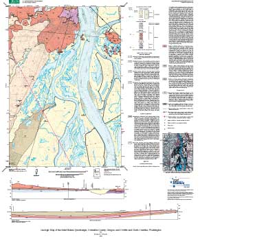 |
| This illustration is a .jpg (JPEG) nonnavigable image of the USGS geologic-map plot of the Mount Saint Helens quadrangle. A full-size, navigable map graphic can be viewed on-screen or plotted (StHelens_map.pdf; 20.1 MB). Note: the full-size plot requires a large-format plotter, and is best reproduced at 600 (or greater) dpi. |
| File
Name |
File
Type and Description |
File
Size |
| README
|
||
| Text-only readme file that explains how to use the digital database |
12 Kb |
|
| DATA |
||
| Package containing shapefiles exported from the personal geodatabase. Includes FGDC-compliant metadata | 4.7 MB |
|
| Compressed package of the digital database for this map. Includes FGDC-compliant metadata. |
8.2 MB |
|
| FILES
for VIEWING and PLOTTING |
||
| STH_geol_text.pdf | PDF file of the descriptive geologic pamphlet that accompanies the map | 548 KB |
| PDF file of map sheet that can be used for viewing map in a browser, as well as for plotting | 20.1
MB |
|
For questions about the content of this report, contact Russ Evarts
Download a current version of Acrobat Reader for free
| Help | PDF help | Western reports main page | Western Scientific Investigations Maps |
| Privacy Statement | Disclaimer | Accessibility |
| Geologic Division | Earth Surface Processes |
This report is available via print on demand.
This report is also available from:
USGS Information Services, Box 25286,
Federal Center, Denver, CO 80225
telephone: 303-202-4210; e-mail: infoservices@usgs.gov