


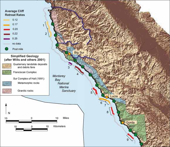
Map showing locations of the nine study sections of coast near Big Sur, California, and the average cliff retreat rates associated with each study section |
The average coastal cliff retreat rate along the Big Sur coast is 18 ± 6 cm/yr as measured over a 52-year time period. The erosion reference features measured as the cliff edge include the well-defined cliff edges common to marine terraces, slight breaks in the slope defining the upper edge of the active lower slope, and the road grade. Cliff erosion and retreat are focused in isolated erosion hotspots that account for most of the calculated average retreat. |
Download Scientific Investigations Map 2853 (.pdf) as a 48x34-inch PDF file (SIM2853.pdf; 3.5 MB)
Download Scientific Investigations Map 2853 (.ai) as an Adobe Illustrator file (SIM2853.ai; 128 MB)
Download Scientific Investigations Map 2853 (.eps) as Encapsulated PostScript file (SIM2853.eps; 258 MB)
For questions about the content of this report, contact Cheryl Hapke
Download a current version of Acrobat Reader for free
| Help
| PDF help
| Western reports main page | Western Scientific Investigations Maps |
| Privacy
Statement | Disclaimer
| Accessibility |
| Geologic
Division | Western Region Coastal & Marine Geology
|
This report is available via print on demand.