Geologic Map of the Edwards Aquifer Recharge Zone, South-Central Texas
Compiled by Charles D. Blome, Jason R. Faith, Diana E. Pedraza, George B. Ozuna, James C. Cole, Allan K. Clark, Ted A. Small, and Robert R. Morris
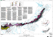
Image of Map
Link to PDF (5 MB)
Introduction
Efforts by a National Cooperative Geologic Mapping Program project to compile the geology of the Edwards aquifer recharge area in south-central Texas have helped to refine the hydrostratigraphy of one of the most permeable and productive carbonate aquifers in the United States. The complex geology of the recharge area includes lithologic units assignable to the Lower Cretaceous Edwards Group and related units and the Georgetown Formation, which is underlain by the Lower Cretaceous Glen Rose Limestone (lower confining unit) and overlain by the Upper Cretaceous Del Rio Clay, Buda Limestone, and Eagle Ford, Austin, and Taylor and Navarro Groups (upper confining units). The rock units comprising the Edwards aquifer in the northeastern part of the recharge area (San Marcos platform facies) include the Kainer, Person, and Georgetown Formations. The Kainer and Person Formations are subdivided into seven informal hydrostratigraphic members. The central part of the recharge area (Devils River trend facies) contains reefal-facies lithologies of the Lower Cretaceous Devils River Formation and the overlying Georgetown Formation. The western part of the recharge area contains Edwards Group lithologies of deeper water origin (Maverick basin facies) composed of the West Nueces, McKnight, Salmon Peak, and Georgetown Formations.
Geologic maps of previous workers typically show a vague, dashed boundary separating San Marcos platform and Devils River trend exposures because the Devils River Formation was historically interpreted as discontinuous and lithologically variable. However, current field studies of the San Marcos platform/Devils River trend...>>MORE
Map PDF (5 MB) Text-only Version(This PDF (305 KB) version of the report is accessible as defined in Section 508 of the Rehabilitation Act of 1973, Amendments of 1998.)