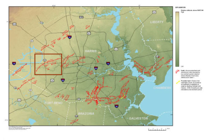
Figure 2. Principal faults in the Houston metropolitan area as observed from 15-foot bare-earth Lidar-derived digital elevation model (DEM).
Back to Contents | Back to Text | Figure 3