
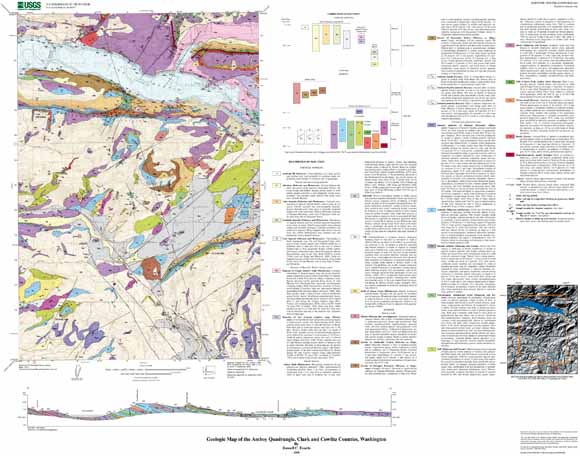
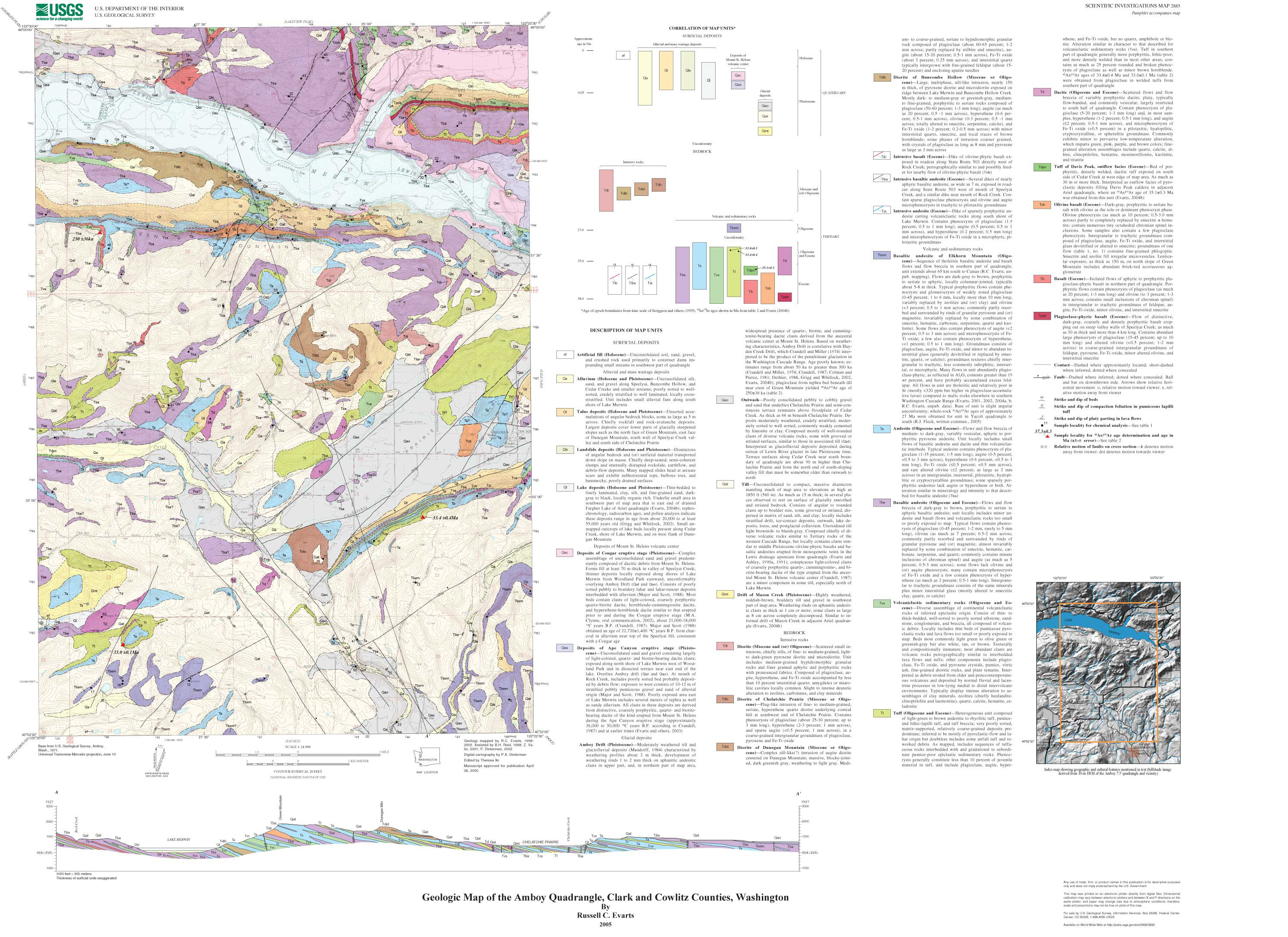
The Amboy 7.5' quadrangle is situated in the foothills of the western Cascade Range approximately 50 km northeast of Portland, Oregon. Since late Eocene time, the Cascade Range has been the locus of an active volcanic arc associated with underthrusting of oceanic lithosphere beneath the North American continent along the Cascadia Subduction Zone. Volcanic and shallow-level intrusive rocks emplaced early in the history of the arc underlie the Amboy quadrangle, forming a dissected and glaciated terrain with elevations as high as 2050 ft (625 m). The quadrangle is transected by two troughs that roughly parallel the east-west structural grain. The northern trough is occupied by Lake Merwin, an artificial reservoir inundating the valley of the Lewis River. The Lewis drains a large area in the southern Washington Cascade Range, including the southern flank of Mount St. Helens, approximately 20 km upstream from the quadrangle, before joining the Columbia River about 25 km west of the quadrangle. The southern trough, which includes Chelatchie Prairie and the lower stretch of Cedar Creek, probably marks a former course of the Lewis River. The Amboy quadrangle lies east of the Portland Basin, which separates the Cascade Range from the Oregon Coast Range. The Portland Basin has been interpreted as a pull-apart basin located in the releasing stepover between two en echelon, northwest-striking, right-lateral fault zones. These fault zones are thought to reflect regional transpression and dextral shear within the forearc in response to oblique subduction of the Pacific Plate. The southwestern margin of the Portland Basin is a well-defined topographic break along the base of the Tualatin Mountains, an asymmetric anticlinal ridge that is bounded on its northeast flank by the Portland Hills Fault Zone, which is probably an active structure. The nature of the corresponding northeastern margin of the basin is less clear, but a poorly defined and partially buried dextral extensional structure has been inferred from topography, microseismicity, potential field-anomalies, and reconnaissance geologic mapping. This map is a contribution to a U.S. Geological Survey program designed to improve the geologic database for the Portland Basin region of the Pacific Northwest urban corridor, the densely populated forearc region of western Washington and Oregon. Better and more detailed information on the bedrock and surficial geology of the basin and its surrounding area is needed to refine assessments of seismic risk, ground-failure hazards, and resource availability in this rapidly growing region. |
| File
Name |
File
Type and Description |
File
Size |
| | ||
| FILES for VIEWING and PLOTTING |
||
| PDF file of the 26-page Geology pamphlet containing description of map | 1.4 MB |
|
| PDF file of 40" x 36" map sheet that can be used for viewing map in a browser, as well as for plotting (geologic map, description of map units, and correlation of map units) | 10.3 MB |
|
| JPG file of 10" x 8" 300 dpi version of the map sheet that can be used for viewing map in a browser or printing on letter-sized paper | 1.8 MB |
|
| README |
||
| PDF readme file that explains the contents of the two data files | 1224 KB |
|
| DATA |
||
| Metadata | 96 KB |
|
| Zipped file that contains geodatabase data objects | 24.9-MB file that opens into a 108.2-MB folder |
|
| Zipped file that contains the shapefile package | 5-MB file that opens into an 14.2-MB folder |
|
For questions about the content of this report, contact Russ Evarts
Version history| Help
| PDF help
| Publications main page | Western Scientific Investigations Maps | This report is available via print on demand.
| Department of the Interior
| U.S. Geological Survey |
URL of this page: https://pubs.usgs.gov/sim/2005/2885/
Maintained by: Michael Diggles
Date created: July 21, 2005
Date last modified: July 21, 2005 (mfd)