Scientific Investigations Map 2975
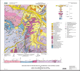 
Abstract Geologic mapping and U-Pb age dating of rocks from the Big Delta B-1 quadrangle, east-central Alaska, have yielded new insights into the geology and gold mineral resource for the headwater region of the Goodpaster River, northeast of Delta, Alaska. The area lies within the Yukon-Tanana Upland and is underlain by Paleozoic and Cretaceous crystalline bedrock and contains several gold mines and prospects. The Paleozoic units include biotite gneiss, quartzite interlayered with metapelite, and amphibolite gneiss. The Paleozoic units were intruded during the Devonian by tonalitic to granitic plutons, which, as a result of regional Mesozoic metamorphism and tectonism, are now augen gneiss and biotite orthogneiss. The Mesozoic regional metamorphism and ductile deformation of the entire Yukon-Tanana Upland culminated by the Late Cretaceous (about 116 Ma) as a result of northwest-directed regional transpression along the southern margin of the North American craton. This dynamothermal episode was followed by invasion of syn- to post-tectonic granodioritic to granitic batholiths during the Late Cretaceous (about 113-107 Ma), followed by a pulse of 100-95 Ma quartz feldspar porphyry intrusions. Gold mineralization is spatially associated with various post-tectonic Late Cretaceous granitic dikes and batholiths throughout the quadrangle. A northeast-trending structural corridor, described herein as the Black Mountain tectonic zone, both controlled the emplacement of some of the Cretaceous intrusive rocks, gold deposits, and prospects, as well as formed a deep-seated crustal conduit along which a subsequent rhyolite flow-dome complex erupted during the Paleocene. Tertiary uplift and erosion resulted in the development of extensive erosional pediments. Quaternary alpine glaciation carved beautiful, broad valleys in the eastern part of the quadrangle, leaving behind terminal moraines in the headwater region of the Goodpaster river drainage. Continued Holocene to Recent deformation along the Black Mountain tectonic zone has offset Tertiary terraces, as well as Quaternary fluvial and alluvial deposits, indicating that the area has a long, complex, and ongoing tectonic history. |
Version 1.0 Posted August 2007
|
Day, W.C., O’Neill, J.M., Aleinikoff, J.N., Green, G.N., Saltus, R.W., and Gough, L.P., 2007, Geologic map of the Big Delta B-1 quadrangle, east-central Alaska: U.S. Geological Survey Scientific Investigations Map 2975, 23-p. pamphlet, 1 plate, scale 1:63,360.

![]() U.S. Department of the Interior | U.S. Geological Survey
U.S. Department of the Interior | U.S. Geological Survey
URL: http://pubsdata.usgs.gov/pubs/sim/2007/2975/index.html
Questions or Assistance: Contact USGS
Last modified: Thursday, 01-Dec-2016 17:08:54 EST
