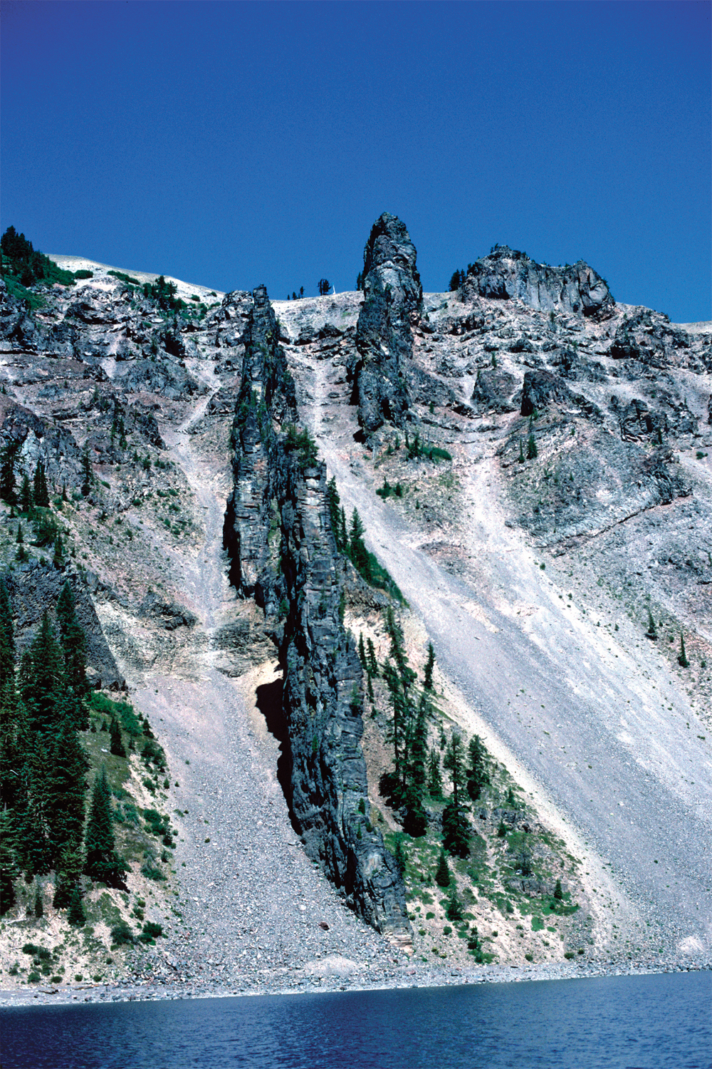
Devils Backbone
27. View northwest shows the two segments of the Devils Backbone dike that cut all four visible lava units (Panorama C): lower andesite below Llao Rock (unit all; 150±9 ka here), andesite of Merriam Point (unit am; 131±18 ka), andesite of the west wall (unit aww; 70±4 ka), and andesite south of The Watchman (unit atw, the lava cliff on the caldera rim to the right of upper dike segment; 62±7 ka here). Lava flows correlated with the Devils Backbone dike (unit ad; ca. 40-50 ka) extend as far as 11 km west of the caldera rim. Highest slope to the left of left dike segment is underlain by dacite of Munson Valley pyroclastic flow (unit dvb; ~35 ka).
Photograph by Charles R. Bacon.