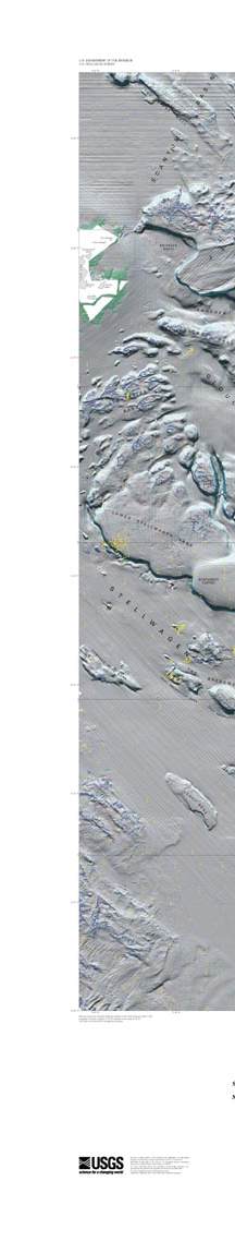
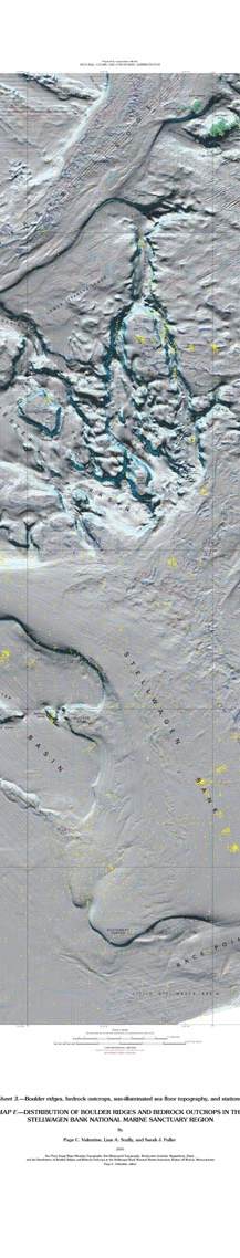
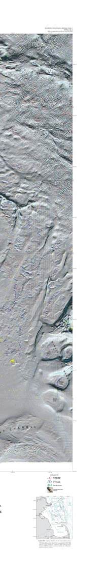
Scientific Investigations Map 2840
|
|||||||||||
| |||||||||||

![]() U.S. Department of the Interior |
U.S. Geological Survey
U.S. Department of the Interior |
U.S. Geological Survey
URL: http://pubsdata.usgs.gov/pubs/sim/2840/HTML/MAPF3_SM.HTM
Page Contact Information: GS Pubs Web Contact
Page Last Modified: Monday, 16-Sep-2024 16:40:08 EDT