|
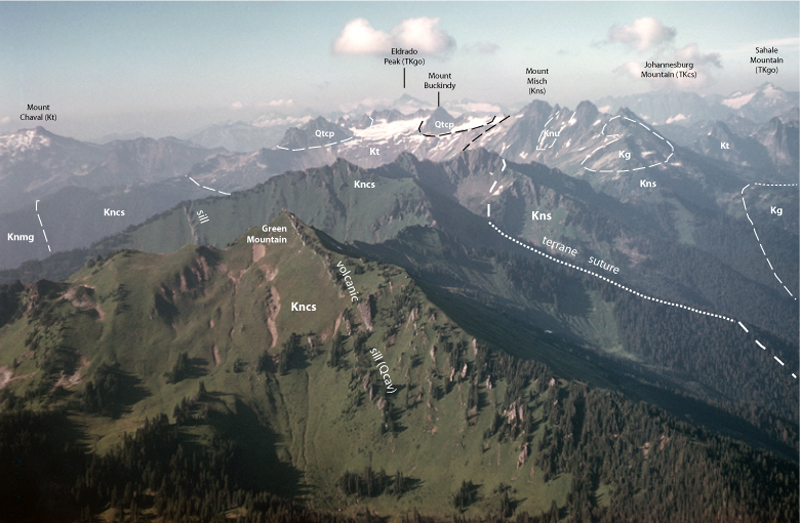
Kncs-1. Aerial view to north near Green Mountain [SRne]. Meadow slopes of Chiwaukum Schist (Kncs) of the Nason terrane are ribbed with erosion-resistant volcanic sills, perhaps related to Glacier Peak volcano (Qcav, out of sight to southeast). A metamorphosed fault, a major terrane suture, separates the Chiwaukum Schist from the Napeequa Schist (Kns) of the Chelan Mountains terrane. Schists of the Chelan Mountain terrane have been intruded by tonalitic plutons (Kt) and granodioritic plutons (Kg). Cretaceous rocks have then been intruded by Cascade Magmatic Arc plutons of the Cascade pass family (QTcp). Knmg, Nason Ridge Migmatitic Gneiss; Knu, ultramafic rocks; TKcs, Cascade River Schist; TKgo, Eldorado Orthogneiss. Contacts (thin lines) and faults (heavy lines) dashed where approximately located and dotted where hidden. Photographed in 1958. View image without annotation
|