
|
|
Scientific Investigations Map 2940 |
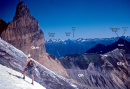
| QTcc-2. South side of Hannegan Peak [MBnw] revealing bedded 4.7 Ma rhyolite tuff of caldera fill (QTcc). Granite Mountain to left (northwest) is eroded from the ~30 Ma Baker River Phase (Tcai) of the Chilliwack batholith. |

|
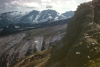
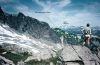
Other photos that show unit QTcc:
     |
 |