|
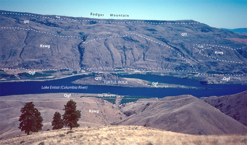
Qgf-1. Pleistocene Missoula flood deposits (Qgf) along Columbia River [Cse]. Badger Mountain is dominated by landslides (QTl) from Yakima Basalt flows (Tyg), which partially bury Wenatchee Formation (rocks of the Ohanepecosh episode, Tcao) that overlies Swakane Biotite Gneiss (Kswg). Turtle Rock is a single large block of gneiss within a landslide. A small alluvial fan mapped as Qu is also shown. View southeast from ridge northeast of Swakane Creek. Contacts dashed where approximately located and dotted where concealed.. View image without annotation
|