|
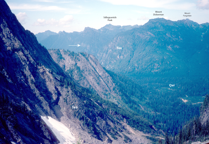
Tev-2. View north from upper reaches of South Fork Stillaguamish River [SRse]. On the west side of the canyon are thick beds of fluvial feldspathic sandstone, sedimentary rocks of the extensional deposits (Tes); across the canyon are volcanic rocks of the extensional deposits (Tev). Both sandstone and volcanic rocks are units in the Barlow Pass Volcanics of Vance (1957a,b). A thick rhyolite tuff bed (marked by an arrow) is visible in the volcanic rocks. Recessional outwash deposits (Qvr) of the Vashon stade of Fraser glaciation of Armstrong and others (1965) are visible in the valley bottom. View image without annotation
|