Abstract
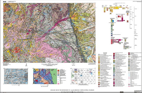 The Denver West quadrangle extends east-west across the entire axis of the Front Range, one of numerous uplifts in the Rocky Mountain region in which Precambrian rocks are exposed. The history of the basement rocks in the Denver West quadrangle is as old as 1,790 Ma. Along the east side of the range, a sequence of sedimentary rocks as old as Pennsylvanian, but dominated by Cretaceous-age rocks, overlies these ancient basement rocks and was upturned and locally faulted during Laramide (Late Cretaceous to early Tertiary) uplift of the range. The increasingly coarser grained sediments up section in rocks of latest Cretaceous to early Tertiary age record in remarkable detail this Laramide period of mountain building. On the west side of the range, a major Laramide fault (Williams Range thrust) places Precambrian rocks over Cretaceous sedimentary rocks. The geologic history of the quadrangle, therefore, can be divided into four major periods: (1) Proterozoic history, (2) Pennsylvanian to pre-Laramide, Late Cretaceous history, (3) Late Cretaceous to early Tertiary Laramide mountain building, and (4) post-Laramide history. In particular, the Quaternary history of the Denver West quadrangle is described in detail, based largely on extensive new mapping. The Denver West quadrangle extends east-west across the entire axis of the Front Range, one of numerous uplifts in the Rocky Mountain region in which Precambrian rocks are exposed. The history of the basement rocks in the Denver West quadrangle is as old as 1,790 Ma. Along the east side of the range, a sequence of sedimentary rocks as old as Pennsylvanian, but dominated by Cretaceous-age rocks, overlies these ancient basement rocks and was upturned and locally faulted during Laramide (Late Cretaceous to early Tertiary) uplift of the range. The increasingly coarser grained sediments up section in rocks of latest Cretaceous to early Tertiary age record in remarkable detail this Laramide period of mountain building. On the west side of the range, a major Laramide fault (Williams Range thrust) places Precambrian rocks over Cretaceous sedimentary rocks. The geologic history of the quadrangle, therefore, can be divided into four major periods: (1) Proterozoic history, (2) Pennsylvanian to pre-Laramide, Late Cretaceous history, (3) Late Cretaceous to early Tertiary Laramide mountain building, and (4) post-Laramide history. In particular, the Quaternary history of the Denver West quadrangle is described in detail, based largely on extensive new mapping.
|

