Scientific Investigations Map 3032
In cooperation with the
PUERTO RICO DEPARTMENT OF NATURAL AND ENVIRONMENTAL RESOURCES
ONLINE ONLY
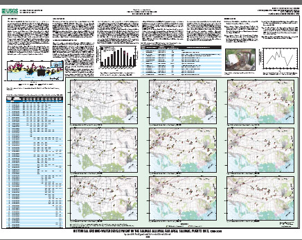 
The Salinas alluvial fan area has historically been one of the most intensively used agricultural areas in the South Coastal Plain of Puerto Rico. Changes in agricultural practices and land use in the Salinas alluvial fan have also caused changes in the geographic distribution of ground-water withdrawals from the alluvial aquifer. As a result, the ground-water balance and ground-water flow pattern have changed throughout the years and may explain the presence of saline ground water along parts of the coast at present. By providing a reconstruction of historical ground-water development in the Salinas alluvial fan area, from the initial years of aquifer development at about 1900 to the most recent conditions existing in 2005, water resources managers and planners can use the results of the analysis for a more complete understanding of aquifer conditions especially pertaining to water quality. This study effort was conducted by the U.S. Geological Survey in cooperation with the Puerto Rico Department of Natural and Environmental Resources as a contribution in the management of the Jobos Bay National Estuarine Research Reserve. The study area encompasses about 20 mi2 (square miles) of the extensive South Coastal Plain alluvial aquifer system (fig. 1). The study area is bounded to the north by foothills of the Cordillera Central mountain chain, to the south by the Caribbean Sea, and to the east and west by the Río Nigua de Salinas and the Quebrada Aguas Verdes, respectively. Fan-delta and alluvial deposits contain the principal aquifers in the study area. |
Posted December 2008 Please visit http://pr.water.usgs.gov/ for more information about USGS activities in the Caribbean (Puerto Rico and the U.S. Virgin Islands).
Part or all of this report is presented in Portable Document Format (PDF); the latest version of Adobe Acrobat Reader or similar software is required to view it. Download the latest version of Acrobat Reader, free of charge or go to access.adobe.com for free tools that allow visually impaired users to read PDF files.
|
Rodríguez, J.M., and Gómez-Gómez, F., 2008, Historical Ground-Water Development in the Salinas Alluvial Fan Area, Salinas, Puerto Rico, 1900-2005: U.S. Geological Survey Scientific Investigations Map 3032, 1 sheet.

![]() U.S. Department of the Interior |
U.S. Geological Survey
U.S. Department of the Interior |
U.S. Geological Survey
URL: http://pubsdata.usgs.gov/pubs/sim/3032/index.html
Page Contact Information: GS Pubs Web Contact
Page Last Modified: Thursday, 01-Dec-2016 17:10:51 EST
