U.S. Geological Survey Scientific Investigations Map 3040
Introduction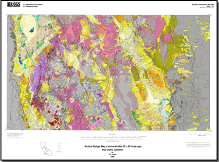
This map shows the distribution of surficial deposits within the Darwin Hills 30’ x 60’ quadrangle, Inyo County, California, located between 36° to 36.5° latitude and 117° to 118° longitude. The quadrangle extends from the southern Owens Valley and Coso Range on the west to the northern and central Panamint Range on the east. Four additional 7.5’ quadrangles are included along the westernmost edge of the quadrangle adjacent to the Sierra Nevada range front to completely show the west side of the Owens Valley basin area. A limited time period was available for mapping the quadrangle; field studies were conducted during the field seasons from 2001 until 2004. Remote sensing images, digital orthophoto quadrangles, and 1:80,000-scale air photos were used extensively to delineate map units in addition to field observations. The map area consists of four principal geologic and geomorphic domains: Quaternary and Pliocene basin deposits, Quaternary and Pliocene volcanic rocks, late Miocene and early Pliocene erosional surfaces or peneplains, and Mesozoic or older plutonic and metamorphic rocks. There is no preserved lithologic record between about 80 Ma and 13 Ma in the map area and most of the Tertiary record is not much older than about 6 to 7 Ma, or early Pliocene and very latest Miocene age. Late Miocene rocks of about 12 to 13 Ma have been identified on the east flank of the Argus Range near Shepherd Canyon, but they occupy less than 1 percent of the map area, although they do occur in much greater abundance in adjacent regions south and east of the map area. This map shows both conventional geologic units and several geomorphic units that show the distribution of pediment surfaces, paleotopography, or other features of tectonic significance. Most of the surficial deposits were shed from present-day mountain ranges. Older Tertiary sedimentary deposits may in part be derived from an ancestral landscape with significantly different headwaters and fluvial systems than are present in the area today. The basins are dominated by late Quaternary alluvial fan and playa deposits. These deposits are regionally differentiated by geomorphic expression, weathering, and erosional characteristics in addition to other stratigraphic properties. The ages of the fan units mainly represent the age of the material exposed at the surface. Extensive areas consist of a thin veneer of alluvial sediment that overlies erosionally developed pediment surfaces. The pediments are annotated with a unit symbol that identifies the primary lithology underlying the clastic veneer to provide additional information about the subsurface geology. In addition to surficial deposits, areas of late Tertiary paleo-erosional surfaces or peneplains have also been mapped based on their geomorphic expression, presence of lag gravels, and lateral continuity with unconformably overlying late Miocene and (or) Pliocene deposits. These relict peneplains provide important strain markers for identifying step-faulting, warping, and tilting of blocks within the ranges (a widespread component of the late Neogene and Quaternary tectonic activity). Significant chronologic studies and geologic mapping preceded this work. The geology of five 1:62,500 scale quadrangles within this map area are published. Tertiary deposits were mapped in the western part of the quadrangle by Stinson. Duffield and Bacon mapped the Quaternary alluvium and volcanic rocks of the Coso Volcanic center at 1:50,000 scale. Tertiary volcanic and clastic alluvial deposits were mapped in the northeastern part of the quadrangle by Hall. Tertiary, mainly Pliocene, basaltic flows are extensive throughout the western and northern parts of the map area (Duffield and others, Bacon and others, Schweig) and provide important structural and chronological event boundaries. A map showing Quaternary faults and lineaments has been published for the east half of the quadrangle at 1:100,000 scale by Reheis; otherwise, little of the extensive surficial basin deposits have been previously mapped in any detail. |
File for viewing and plotting
GIS data
For additional information: Part of this report is presented in Portable Document Format (PDF); the latest version of Adobe Reader or similar software is required to view it. Download the latest version of Adobe Reader, free of charge. |
Jayko, A.S., 2009, Surficial geologic map of the Darwin Hills 30' x 60' quadrangle, Inyo County, California: U.S. Geological Survey Scientific Investigations Map 3040, 20 p. pamphlet, 2 plates, scale 1:100,000.

![]() U.S. Department of the Interior |
U.S. Geological Survey
U.S. Department of the Interior |
U.S. Geological Survey
URL: http://
pubsdata.usgs.gov
/pubs/sim/3040/index.html
Page Contact Information: USGS Publications Team
Page Last Modified: Thursday, 01-Dec-2016 17:19:24 EST
