Scientific Investigations Map 3042
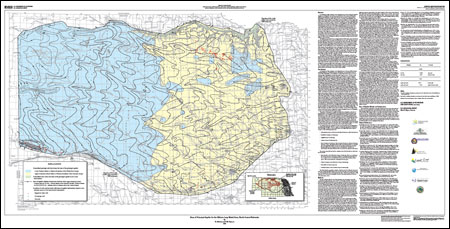
AbstractIn Nebraska, the water managers in the Natural Resources Districts and the Nebraska Department of Natural Resources are concerned with the effect of ground-water withdrawal on the availability of surface water and the long-term effects of ground-water withdrawal on ground- and surface-water resources. In north-central Nebraska, in the Elkhorn and Loup River Basins, ground water is used for irrigation, domestic supply, and public supply; surface water is used in this area for irrigation, recreation, and hydropower production. In recognition of these sometimes competing ground- and surface-water uses in the Elkhorn and Loup River Basins, the U.S. Geological Survey, the Lewis and Clark Natural Resources District, the Lower Elkhorn Natural Resources District, the Lower Loup Natural Resources District, the Lower Niobrara Natural Resources District, the Lower Platte North Natural Resources District, the Middle Niobrara Natural Resources District, the Upper Elkhorn Natural Resources District, and the Upper Loup Natural Resources District agreed to cooperatively study water resources in the Elkhorn and Loup River Basins. The goals of the overall study were to construct and calibrate a regional ground-water flow model of the area and to use that flow model as a tool to assess current and future effects of ground-water irrigation on stream base flow and to help develop long-term water-resource management strategies for this area, hereafter referred to as the Elkhorn-Loup model area. The Elkhorn-Loup model area covers approximately 30,800 square miles, and extends from the Niobrara River in the north to the Platte River in the south. The western boundary of the Elkhorn-Loup model area coincides with the western boundary of the Middle Niobrara, Twin Platte, and Upper Loup Natural Resources Districts; the eastern boundary coincides with the approximate location of the western extent of glacial till in eastern Nebraska. The principal aquifer in most of the Elkhorn-Loup model area is the High Plains aquifer; the principal aquifer in the remaining part of the Elkhorn-Loup model area is an unnamed alluvial aquifer. The upper surface of the geologic units that directly underlie the aquifer is called the "base of aquifer" in this report. The geologic unit that forms the base of aquifer in the Elkhorn-Loup model area varies by location. The Tertiary-age Brule Formation generally is the base of aquifer in the west; the Cretaceous-age Pierre Shale generally is the base of aquifer in the east. The purpose of this report is to update the altitude and configuration of the base of the principal aquifer in the Elkhorn-Loup model area and a 2-mile buffer area around the Elkhorn-Loup model area, using base-of-aquifer data from test holes, registered water wells, and oil and gas wells within the Elkhorn-Loup model area and a 20-mile buffer area around the Elkhorn-Loup model area that have become available since the publication of earlier maps of the base of aquifer for this area. The base-of-aquifer map is important for the Elkhorn-Loup ground-water flow model because it defines the model’s lower boundary. The accuracy of the Elkhorn-Loup ground-water flow model and the accuracy of the model’s predictions about the effects of ground-water irrigation on stream base flow are directly related to the accuracy of the model"s lower boundary. |
Associated Data:
For additional information contact: Part or all of this report is presented in Portable Document Format (PDF); the latest version of Adobe Reader or similar software is required to view it. Download the latest version of Adobe Reader, free of charge. |
McGuire, V.L., and Peterson, S.M., 2008, Base of principal aquifer for the Elkhorn-Loup model area, north-central Nebraska: U.S. Geological Survey, Scientific Investigations Map 3042, 1 sheet, available on the Web at https://pubs.usgs.gov/sim/3042

![]() U.S. Department of the Interior | U.S. Geological Survey
U.S. Department of the Interior | U.S. Geological Survey
URL: http://pubsdata.usgs.gov/pubs/sim/3042/index.html
Questions or Assistance: Contact USGS
Last modified: Thursday, 01-Dec-2016 17:12:06 EST
