Georgia Water Science Center
![]() This report is available online only in pdf format (2 Mb): USGS SIM 3058
This report is available online only in pdf format (2 Mb): USGS SIM 3058
Note: This report is a poster that is 42 inches wide by 32 inches high.
Peck, M.F., Leeth, D.C., and Hamrick, M.D.
U.S. Geological Survey Scientific Investigations Map 3058, 1 page (Published November 2008)
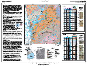 The U.S. Geological Survey (USGS)in cooperation with the Troup County Board of Commissioners—conducted a well inventory to provide information to help evaluate ground-water resources for Troup County, Georgia. In addition, borehole geophysical logs were collected in selected wells to provide a better understanding of the subsurface geologic and water-bearing characteristics in specific areas of interest. This investigation provides information to help guide future ground-water development and water-management decisions for Troup County while enhancing understanding of the hydrogeology of fractured rocks in the Piedmont physiographic province. This report presents well data compiled from USGS files and from site visits to wells during November and December 2007. Data were entered into the USGS National Water Information System (NWIS) and made available on the Web at http://waterdata.usgs.gov/ga/nwis/inventory.
Previous studies of ground-water resources have been conducted in the vicinity, but did not include Troup County. The ground-water resources of Heard and Coweta Counties, located north and northeast, respectively, of Troup County were part of a larger study by Cressler and others (1983) that encompassed the Greater Atlanta Region. That study evaluated the quantity and quality of ground water in the Atlanta region and described the methods that could be used for locating high-yielding wells in the Piedmont Province. The geology underlying the Atlanta area is similar to that underlying Troup County. Clarke and Peck (1990) conducted a similar investigation that included Meriwether and Coweta Counties, located to the east and northeast of Troup County.
Introduction
Well Identification System
Acknowledgments
Description of the Study Area
Well Inventory
Geophysical-Log Data Collection
Selected References
![]() This report is available online only in pdf format (2 Mb): USGS SIM 3058
This report is available online only in pdf format (2 Mb): USGS SIM 3058
Note: This report is a poster that is 42 inches wide by 32 inches high.
Suggested citation:
Peck, M.F., Leeth, D.C., and Hamrick, M.D, 2008, Well Inventory and Geophysical Logging of Selected Wells in Troup County, Georgia, 2007—2008: U.S. Geological Survey Scientific Investigations Map 3058, 1 p.
Recent USGS publications for Georgia or Georgia Water-Resources Information
For more information, please contact webmaster-ga@usgs.gov.

![]() U.S. Department of the Interior |
U.S. Geological Survey
U.S. Department of the Interior |
U.S. Geological Survey
URL: https://pubsdata.usgs.gov/pubs/sim/3058/index.html
Page Contact Information: Publications Team
Page Last Modified: Thursday, 01-Dec-2016 17:12:39 EST