U.S. Geological Survey Scientific Investigations Map 3109
Introduction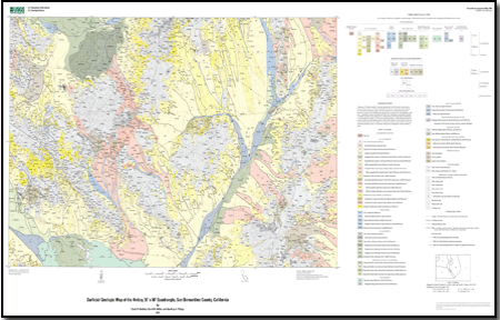
The surficial geologic map of the Amboy 30’ x 60’ quadrangle presents characteristics of surficial materials for an area of approximately 5,000 km2 in the eastern Mojave Desert of southern California. This map consists of new surficial mapping conducted between 2000 and 2007, as well as compilations from previous surficial mapping. Surficial geologic units are mapped and described based on depositional process and age categories that reflect the mode of deposition, pedogenic effects following deposition, and, where appropriate, the lithologic nature of the material. Many physical properties were noted and measured during the geologic mapping. This information was used to classify surficial deposits and to understand their ecological importance. We focus on physical properties that drive hydrologic, biologic, and physical processes such as particle-size distribution (PSD) and bulk density. The database contains point data representing locations of samples for both laboratory determined physical properties and semiquantitative field-based information in the database. We include the locations of all field observations and note the type of information collected in the field to help assist in assessing the quality of the mapping. The publication is separated into three parts: documentation, spatial data, and printable map graphics of the database. Documentation includes this pamphlet, which provides a discussion of the surficial geology and units and the map. Spatial data are distributed as ArcGIS Geodatabase in Microsoft Access format and are accompanied by a readme file, which describes the database contents, and FGDC metadata for the spatial map information. Map graphics files are distributed as Postscript and Adobe Portable Document Format (PDF) files that provide a view of the spatial database at the mapped scale. |
Last modified August 9, 2010
Files for Viewing and PlottingGeologic Map Database Files and Associated Files
For additional information: Part of this report is presented in Portable Document Format (PDF); the latest version of Adobe Reader or similar software is required to view it. Download the latest version of Adobe Reader, free of charge. |
Bedford, D.R., Miller, D.M. and Phelps, G.A., 2010, Surficial geologic map of the Amboy 30' x 60' quadrangle, San Bernardino County, California: U.S. Geological Survey Scientific Investigations Map 3109, scale 1:100,000.

![]() U.S. Department of the Interior |
U.S. Geological Survey
U.S. Department of the Interior |
U.S. Geological Survey
URL: http://
pubsdata.usgs.gov
/pubs/sim/3109/index.html
Page Contact Information: USGS Publications Team
Page Last Modified: Thursday, 01-Dec-2016 17:19:13 EST
