U.S. Geological Survey Scientific Investigations Map 3124
Introduction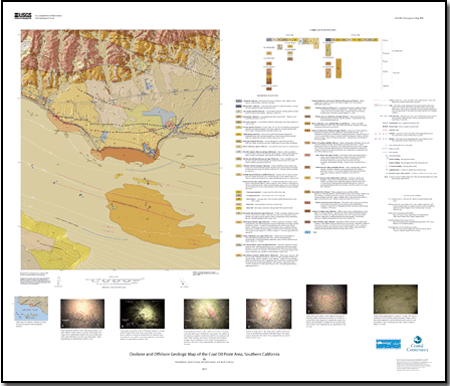
Geologic maps that span the shoreline and include both onshore and offshore areas are potentially valuable tools that can lead to a more in depth understanding of coastal environments. Such maps can contribute to the understanding of shoreline change, geologic hazards, both offshore and along-shore sediment and pollutant transport. They are also useful in assessing geologic and biologic resources. Several intermediate-scale (1:100,000) geologic maps that include both onshore and offshore areas (herein called onshore-offshore geologic maps) have been produced of areas along the California coast (see Saucedo and others, 2003; Kennedy and others, 2007; Kennedy and Tan, 2008), but few large-scale (1:24,000) maps have been produced that can address local coastal issues. A cooperative project between Federal and State agencies and universities has produced an onshore-offshore geologic map at 1:24,000 scale of the Coal Oil Point area and part of the Santa Barbara Channel, southern California (fig. 1). As part of the project, the U.S. Geological Survey (USGS) and the California Geological Survey (CGS) hosted a workshop (May 2nd and 3rd, 2007) for producers and users of coastal map products (see list of participants) to develop a consensus on the content and format of onshore-offshore geologic maps (and accompanying GIS files) so that they have relevance for coastal-zone management. The USGS and CGS are working to develop coastal maps that combine geospatial information from offshore and onshore and serve as an important tool for addressing a broad range of coastal-zone management issues. The workshop was divided into sessions for presentations and discussion of bathymetry and topography, geology, and habitat products and needs of end users. During the workshop, participants reviewed existing maps and discussed their merits and shortcomings. This report addresses a number of items discussed in the workshop and details the onshore and offshore geologic map of the Coal Oil Point area. Results from this report directly address issues raised in the California Ocean Protection Act (COPA) Five Year Strategic Plan. For example, one of the guiding principles of the COPA five-year strategic plan is to “Recognize the interconnectedness of the land and the sea, supporting sustainable uses of the coast and ensuring the health of ecosystems.” Results from this USGS report directly connect the land and sea with the creation of both a seamless onshore and offshore digital terrain model (DTM) and geologic map. One of the priority goals (and objectives) of the COPA plan is to “monitor and map the ocean environment to provide data about conditions and trends.” Maps within this report provide land and sea geologic information for mapping and monitoring nearshore sediment processes, pollution transport, and sea-level rise and fall. |
Files for plotting and printingData
For additional information: Part of this report is presented in Portable Document Format (PDF); the latest version of Adobe Reader or similar software is required to view it. Download the latest version of Adobe Reader, free of charge. |
Dartnell, Pete, Conrad, James E., Stanley, Richard G., and Cochrane, Guy R., 2010, Onshore and offshore geologic map of the Coal Oil Point area, southern California: U.S. Geological Survey Scientific Investigations Map 3124, scale 1:24,000, pamphlet 18 p., and database.

![]() U.S. Department of the Interior |
U.S. Geological Survey
U.S. Department of the Interior |
U.S. Geological Survey
URL: http://pubsdata.usgs.gov/pubs/sim/3124/index.html
Page Contact Information: GS Pubs Web Contact
Page Last Modified: Thursday, 01-Dec-2016 17:21:54 EST
