U.S. Geological Survey Scientific Investigations Map 3131
IntroductionThis 1:500,000-scale geologic map depicts the bedrock geology of Seward Peninsula, western Alaska, on the North American side of the Bering Strait. The map encompasses all of the Teller, Nome, Solomon, and Bendeleben 1:250,000-scale quadrangles, and parts of the Shishmaref, Kotzebue, Candle, and Norton Bay 1:250,000-scale quadrangles (sh. 1; sh. 2). The geologic map is presented on Sheet 1. The pamphlet includes an introductory text, detailed unit descriptions, tables of geochronologic data, and an appendix containing conodont (microfossil) data and a text explaining those data. Sheet 2 shows metamorphic and tectonic units, conodont color alteration indices, key metamorphic minerals, and locations of geochronology samples listed in the pamphlet. The map area covers 74,000 km², an area slightly larger than West Virginia or Ireland. 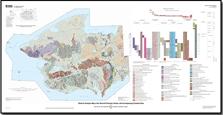
|
Files for viewing and printing:
Data:
For additional information contact: Part of this report is presented in Portable Document Format (PDF); the latest version of Adobe Reader or similar software is required to view it. Download the latest version of Adobe Reader, free of charge. |
Till, A.B., Dumoulin, J.A., Werdon, M.B., and Bleick, H.A., 2011, Bedrock geologic map of the Seward Peninsula, Alaska, and accompanying conodont data: U.S. Geological Survey Scientific Investigations Map 3131, 2 sheets, scale 1:500,000, 1 pamphlet, 75 p., and database, available at https://pubs.usgs.gov/sim/3131/.

![]() U.S. Department of the Interior |
U.S. Geological Survey
U.S. Department of the Interior |
U.S. Geological Survey
URL: http://pubsdata.usgs.gov/pubs/sim/3131/index.html
Page Contact Information: GS Pubs Web Contact
Page Last Modified: Thursday, 01-Dec-2016 17:23:37 EST
