Scientific Investigations Map 3166
INTRODUCTIONThe Geospatial Characteristics GeoPDF of Florida’s Coastal and Offshore Environments is a comprehensive collection of geospatial data describing the political boundaries and natural resources of Florida. This interactive map provides spatial information on bathymetry, sand resources, and locations of important habitats (for example, Essential Fish Habitats (EFH), nesting areas, strandings) for marine invertebrates, fish, reptiles, birds, and marine mammals. The map should be useful to coastal resource managers and others interested in marine habitats and submerged obstructions of Florida's coastal region. In particular, as oil and gas explorations continue to expand, the map can be used to explore information regarding sensitive areas and resources in the State of Florida. Users of this geospatial database will have access to synthesized information in a variety of scientific disciplines concerning Florida’s coastal zone. This powerful tool provides a one-stop assembly of data that can be tailored to fit the needs of many natural resource managers. The map was originally developed to assist the Bureau of Ocean Energy Management, Regulation, and Enforcement (BOEMRE) and coastal resources managers with planning beach restoration projects. The BOEMRE uses a systematic approach in planning the development of submerged lands of the Continental Shelf seaward of Florida's territorial waters. Such development could affect the environment. BOEMRE is required to ascertain the existing physical, biological, and socioeconomic conditions of the submerged lands and estimate the impact of developing these lands. Data sources included the National Oceanic and Atmospheric Administration, BOEMRE, Florida Department of Environmental Protection, Florida Geographic Data Library, Florida Fish and Wildlife Conservation Commission, Florida Natural Areas Inventory, and the State of Florida, Bureau of Archeological Research. Federal Geographic Data Committee (FGDC) compliant metadata are provided as attached xml files for all geographic information system (GIS) layers. |
First posted May 25, 2011
For additional information contact: Part or all of this report is presented in Portable Document Format (PDF); the latest version of Adobe Reader or similar software is required to view it. Download the latest version of Adobe Reader, free of charge. |
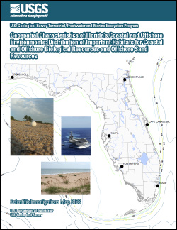
Demopoulos, A.W.J., Foster, A.M., Jones, M.L., and Gualtieri, D.J., 2011, Geospatial characteristics of Florida's coastal and offshore environments: Distribution of important habitats for coastal and offshore biological resources and offshore sand resources: U.S. Geological Survey Scientific Investigations Map 3166, 11 p.

![]() U.S. Department of the Interior |
U.S. Geological Survey
U.S. Department of the Interior |
U.S. Geological Survey
URL: http://pubsdata.usgs.gov/pubs/sim/3166/index.html
Page Contact Information: USGS Publications Team
Page Last Modified: Thursday, 01-Dec-2016 17:23:03 EST
