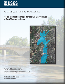
Scientific Investigations Map 3205
|
|||||||||||||||||||||||||
| Normal and low resolution PDFs are available for each stream stage. |
| Normal Resolution Map sheet 1 PDF (16.0 MB) |
Low Resolution Map sheet 1 PDF (1.4 MB) |
| Normal Resolution Map sheet 2 PDF (16.0 MB) |
Low Resolution Map sheet 2 PDF (1.4 MB) |
| Normal Resolution Map sheet 3 PDF (16.0 MB) |
Low Resolution Map sheet 3 PDF (1.4 MB) |
| Normal Resolution Map sheet 4 PDF (16.0 MB) |
Low Resolution Map sheet 4 PDF (1.4 MB) |
| Normal Resolution Map sheet 5 PDF (16.0 MB) |
Low Resolution Map sheet 5 PDF (1.4 MB) |
| Normal Resolution Map sheet 6 PDF (16.0 MB) |
Low Resolution Map sheet 6 PDF (1.4 MB) |
| Normal Resolution Map sheet 7 PDF (16.0 MB) |
Low Resolution Map sheet 7 PDF (1.4 MB) |
| Normal Resolution Map sheet 8 PDF (16.0 MB) |
Low Resolution Map sheet 8 PDF (1.4 MB) |
| Normal Resolution Map sheet 9 PDF (16.0 MB) |
Low Resolution Map sheet 9 PDF (1.4 MB) |
| Normal Resolution Map sheet 10 PDF (16.0 MB) |
Low Resolution Map sheet 10 PDF (1.4 MB) |
| Normal Resolution Map sheet 11 PDF (16.0 MB) |
Low Resolution Map sheet 11 PDF (1.4 MB) |
First posted June 22, 2012
Stream stage of 12 ft, Sheet 1
Stream stage of 13 ft, Sheet 2
Stream stage of 14 ft, Sheet 3
Stream stage of 15 ft, Sheet 4
Stream stage of 16 ft, Sheet 5
Stream stage of 17 ft, Sheet 6
Stream stage of 18 ft, Sheet 7
Stream stage of 19 ft, Sheet 8
Stream stage of 20 ft, Sheet 9
Stream stage of 21 ft, Sheet 10
Stream stage of 22 ft, Sheet 11
For additional information contact:
Director, Indiana Water Science Center
U.S. Geological Survey
5957 Lakeside Blvd.
Indianapolis, IN 46278
(317) 290-3333
http://in.water.usgs.gov
Part of this report is presented in Portable Document Format (PDF); the latest version of Adobe Reader or similar software is required to view it. Download the latest version of Adobe Reader, free of charge.
Menke, C.D., Kim, M.H., and Fowler, K.K., 2012, Flood-inundation maps for the St. Marys River at Fort Wayne, Indiana: U.S. Geological Survey Scientific Investigations Map 3205, 7 p. pamphlet, 11 sheets, scale 1:36,000.
Abstract
Introduction
Purpose and Scope
Study Area Description
Previous Studies
Constructing Water-Surface Profiles
Hydrologic and Steady Flow Data
Topographic/Bathymetric Data
Energy Loss Factors
Model Calibration and Performance
Development of Water-Surface Profiles
Inundation Mapping
St. Marys River, Indiana Flood-Inundation Maps on the Internet
Disclaimer for Flood-Inundation Maps
Uncertainties and Limitations for Use of Flood-Inundation Maps
Acknowledgments
Summary
References Cited

![]() U.S. Department of the Interior |
U.S. Geological Survey
U.S. Department of the Interior |
U.S. Geological Survey
URL: http://pubsdata.usgs.gov/pubs/sim/3205/index.html
Page Contact Information: GS Pubs Web Contact
Page Last Modified: Thursday, 01-Dec-2016 17:25:53 EST