 Abstract Abstract
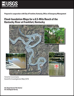
Digital flood-inundation maps for a 6.5-mile reach of Kentucky River at Frankfort, Kentucky, were created by the U.S. Geological Survey (USGS) in cooperation with the City of Frankfort Office of Emergency Management. The inundation maps, which can be accessed through the USGS Flood Inundation Mapping Science Web site at http://water.usgs.gov/osw/flood_inundation/, depict estimates of the areal extent and depth of flooding corresponding to selected water levels (stages) at the USGS streamgage Kentucky River at Lock 4 at Frankfort, Kentucky (station no. 03287500). Current conditions for the USGS streamgage may be obtained online at the USGS National Water Information System site (http://waterdata.usgs.gov/nwis/inventory?agency_code=USGS&site_no=03287500). In addition, the information has been provided to the National Weather Service (NWS) for incorporation into their Advanced Hydrologic Prediction Service (AHPS) flood warning system (http:/water.weather.gov/ahps/). The NWS forecasts flood hydrographs at many places that are often colocated at USGS streamgages. The forecasted peak-stage information, also available on the Internet, may be used in conjunction with the maps developed in this study to show predicted areas of flood inundation.
In this study, flood profiles were computed for the Kentucky River reach by using HEC–RAS, a one-dimensional step-backwater model developed by the U.S. Army Corps of Engineers. The hydraulic model was calibrated by using the most current (2013) stage-discharge relation for the Kentucky River at Lock 4 at Frankfort, Kentucky, in combination with streamgage and high-water-mark measurements collected for a flood event in May 2010. The calibrated model was then used to calculate 26 water-surface profiles for a sequence of flood stages, at 1-foot intervals, referenced to the streamgage datum and ranging from a stage near bankfull to the elevation that breached the levees protecting the City of Frankfort. To delineate the flooded area at each interval flood stage, the simulated water-surface profiles were combined with a digital elevation model (DEM) of the study area by using geographic information system software. The DEM consisted of bare-earth elevations within the study area and was derived from a Light Detection And Ranging (LiDAR) dataset having a 5.0-foot horizontal resolution and an accuracy of 0.229 foot.
The availability of these maps, along with Internet information regarding current stages from USGS streamgages and forecasted stages from the NWS, provides emergency management personnel and local residents with critical information for flood response activities such as evacuations, road closures, and postflood recovery efforts.
|
First posted January 2, 2014
Part or all of this report is presented in Portable Document Format (PDF). For best results viewing and printing PDF documents, it is recommended that you download the documents to your computer and open them with Adobe Reader. PDF documents opened from your browser may not display or print as intended. Download the latest version of Adobe Reader, free of charge.
|

