Skip Links

USGS - science for a changing world

Scientific Investigations Map 3298

Geologic Map and Upper Paleozoic Stratigraphy of the Marble Canyon Area, Cottonwood Canyon Quadrangle, Death Valley National Park, Inyo County, California

By Paul Stone, Calvin H. Stevens, Paul Belasky, Isabel P. Montañez, Lauren G. Martin, Bruce R. Wardlaw, Charles A. Sandberg, Elmira Wan, Holly A. Olson, and Susan S. Priest

Thumbnail of and link to report PDF (8.8 MB)Abstract

This geologic map and pamphlet focus on the stratigraphy, depositional history, and paleogeographic significance of upper Paleozoic rocks exposed in the Marble Canyon area in Death Valley National Park, California. Bedrock exposed in this area is composed of Mississippian to lower Permian (Cisuralian) marine sedimentary rocks and the Jurassic Hunter Mountain Quartz Monzonite. These units are overlain by Tertiary and Quaternary nonmarine sedimentary deposits that include a previously unrecognized tuff to which we tentatively assign an age of late middle Miocene (~12 Ma) based on tephrochronologic analysis, in addition to the previously recognized Pliocene tuff of Mesquite Spring.

Mississippian and Pennsylvanian rocks in the Marble Canyon area represent deposition on the western continental shelf of North America. Mississippian limestone units in the area (Tin Mountain, Stone Canyon, and Santa Rosa Hills Limestones) accumulated on the outer part of a broad carbonate platform that extended southwest across Nevada into east-central California. Carbonate sedimentation was interrupted by a major eustatic sea-level fall that has been interpreted to record the onset of late Paleozoic glaciation in southern Gondwana. Following a brief period of Late Mississippian clastic sedimentation (Indian Springs Formation), a rise in eustatic sea level led to establishment of a new carbonate platform that covered most of the area previously occupied by the Mississippian platform. The Pennsylvanian Bird Spring Formation at Marble Canyon makes up the outer platform component of ten third-order (1 to 5 m.y. duration) stratigraphic sequences recently defined for the regional platform succession.

The regional paleogeography was fundamentally changed by major tectonic activity along the continental margin beginning in middle early Permian time. As a result, the Pennsylvanian carbonate shelf at Marble Canyon subsided and was disconformably overlain by lower Permian units (Osborne Canyon and Darwin Canyon Formations) representing part of a deep-water turbidite basin filled primarily by fine-grained siliciclastic sediment derived from cratonal sources to the east. Deformation and sedimentation along the western part of this basin continued into late Permian time. The culminating phase was part of a regionally extensive late Permian thrust system that included the Marble Canyon thrust fault just west of the present map area.

First posted June 30, 2014

For additional information, contact:
Contact Information, Geology, Minerals, Energy, & Geophysics Science Center
Menlo Park, California
U.S. Geological Survey
345 Middlefield Road
Menlo Park, CA 94025-3591
http://geomaps.wr.usgs.gov/

Part or all of this report is presented in Portable Document Format (PDF). For best results viewing and printing PDF documents, it is recommended that you download the documents to your computer and open them with Adobe Reader. PDF documents opened from your browser may not display or print as intended. Download the latest version of Adobe Reader, free of charge.


Suggested citation:

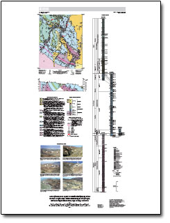
Stone, P., Stevens, C.H., Belasky, P., Montanez, I.P., Martin, L.G., Wardlaw, B.R., Sandberg, C.A., Wan, E., Olson, H.A., and Priest, S.S., 2014, Geologic map and upper Paleozoic stratigraphy of the Marble Canyon area, Cottonwood Canyon quadrangle, Death Valley National Park, Inyo County, California: U.S. Geological Survey Scientific Investigations Map 3298, scale 1:24,000, 59 p., https://dx.doi.org/10.3133/sim3298.

ISSN 2329–132X (online)


Contents

Introduction

Geologic Framework

Upper Paleozoic Stratigraphy and Depositional Environments

Late Paleozoic Depositional and Paleogeographic History

References Cited

Appendixes 1—8


Accessibility FOIA Privacy Policies and Notices

Take Pride in America logo USA.gov logo U.S. Department of the Interior | U.S. Geological Survey
URL: http://pubsdata.usgs.gov/pubs/sim/3298/index.html
Page Contact Information: GS Pubs Web Contact
Page Last Modified: Thursday, 01-Dec-2016 17:31:40 EST