 Introduction
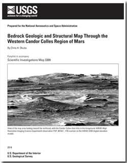
The Candor Colles are a population of low, conical hills along the southeast flank of Ceti Mensa, in west Candor Chasma, within the Valles Marineris system of Mars (fig. 1). Ceti Mensa and the adjacent Candor Mensa are mounds of layered sedimentary deposits and are the most prominent landforms within west Candor Chasma. Prior to the arrival of the Mars Reconnaissance Orbiter (MRO) in orbit around Mars in 2006 (Zurek and Smrekar, 2007), geologic maps of the area utilized the relatively low resolution Viking Orbiter photomosaics (20–150 m/pixel). Geologic maps covering west Candor Chasma were created at scales of 1:15,000,000 for the western equatorial region of Mars (Scott and Tanaka, 1986), 1:2,000,000 for the Valles Marineris region (Witbeck and others, 1991), and 1:500,000 for the far eastern part of west Candor Chasma (Mars Transverse Mercator quadrangle–05072; Lucchitta, 1999).
Previous structural mapping in west Candor Chasma at scales of less than 1:24,000 (Okubo and others, 2008; Okubo, 2010) employed digital terrain models (DTMs), with 1-m post spacings, derived from stereo MRO High Resolution Imaging Science Experiment (HiRISE) imagery (McEwen and others, 2010) and focused on examining the relative timing between deposition of the youngest unit of the layered deposits in this area (unit Avme of Witbeck and others, 1991) relative to regional faulting related to chasma formation. These previous mapping efforts on the southwest flank of Ceti Mensa demonstrated that unit Avme is not deformed by faults attributed to formation of the chasma. Studies of other layered deposits (primarily unit Hvl, but also including units Avme, Avsl, Avsd, and Avfs; Witbeck and others, 1991) exposed along the southeast flank of Ceti Mensa using a High-Resolution Stereo Camera (HRSC) digital terrain model (DTM) (50 m/pixel) refined the local stratigraphy and revealed evidence for syntectonic deposition of these deposits (Fueten and others, 2006, 2008; Jaumann and others, 2007; Birnie and others, 2012).
Layered deposits such as those that constitute Ceti Mensa are widespread throughout the interior regions of Valles Marineris (Witbeck and others, 1991). These sedimentary deposits have been variously interpreted as eolian sediments (Nedell and others, 1987), hyaloclastic debris (Chapman and Tanaka, 2001; Komatsu and others, 2004), lacustrine or fluvial sediment (Dromart and others, 2007; Mangold and others, 2008; Metz and others, 2009), pyroclastic deposits (Hynek and others, 2003), evaporites (Mangold and others, 2008; Andrews-Hanna and others, 2010), or various combinations thereof.
Recent analysis of data from the MRO Compact Reconnaissance Imaging Spectrometer for Mars (CRISM) shows that these sediments consist primarily of hydrated sulfates (Murchie and others, 2009a,b). Further, hydrologic modeling indicates that spring-fed lakes likely occurred within the chasma (Andrews-Hanna and others, 2010). These recent findings point to a scenario in which the layered deposits accumulated as sequences of evaporites precipitating in hypersaline lakes, with contemporaneous trapping of eolian dust and sand, diagenesis, and iron-cycling, interspersed with periods of eolian and fluvial erosion (Murchie and others, 2009a). Water vapor released from these lakes may have also driven localized precipitation of snow and accumulation of layered deposits on the adjacent plateaus (Kite and others, 2011a,b). This scenario is in contrast to recent alternative interpretations that the layered deposits formed within the chasma through weathering of dust-rich ice deposits (Niles and Michalski, 2009; Michalski and Niles, 2012).
The structure and geology of the layered deposits in the Candor Colles region corresponding to units Avfs, Avme, and Hvl of Witbeck and others (1991) are reevaluated in this 1:18,000-scale map. The objectives herein are to gather high-resolution structural measurements to (1) refine the previous unit boundaries in this area established by Witbeck and others (1991), (2) revise the local stratigraphy where necessary, (3) characterize bed forms to help constrain depositional processes, and (4) determine the styles and extent of deformation to better inform reconstructions of the local post-depositional geologic history.

