 Introduction Introduction
This map is an interpretation of a 6-ft-resolution lidar-derived digital elevation model combined
with geology by Derek B. Booth and Kathy Goetz Troost. Field work by Booth and Troost was located
on the 1:24,000-scale topographic map of the Vashon and Des Moines 7.5' quadrangles that were
published in 1997 and 1995, respectively. Much of the geology was interpreted from landforms
portrayed on the topographic maps, supplemented by field exposures, where available. In 2001, the
Puget Sound Lidar Consortium (see http://pugetsoundlidar.org/) obtained a lidar-derived digital
elevation model (DEM) for Vashon Island and the Des Moines quadrangle. For a brief description of
lidar and this data acquisition program, see Haugerud and others (2003). This new DEM has a horizontal
resolution of 6 ft (1.83 m) and mean vertical accuracy of about 1 ft (about 0.3 m). The greater resolution
and accuracy of the lidar DEM facilitated a much-improved interpretation of many aspects of the
surficial geology, especially the distribution and relative age of landforms and the materials inferred to
comprise them. Booth and Troost were joined by Tabor to interpret the new lidar DEM but have done no
futher field work for this map.
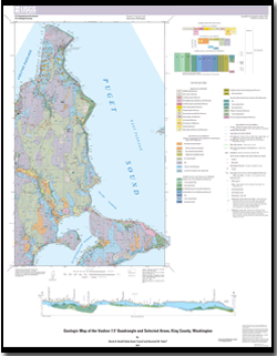
This map, the Vashon quadrangle and selected adjacent areas, encompasses most of Vashon
Island, Maury Island, and Three Tree Point in the south-central Puget Sound. One small area in the
Vashon quadrangle on the east side of Puget Sound is excluded from this map but included on the
adjacent Seattle quadrangle (Booth and others, 2005). The map displays a wide variety of surficial
geologic deposits, which reflect many geologic environments and processes. Multiple ice-sheet
glaciations and intervening nonglacial intervals have constructed a complexly layered sequence of
deposits that underlie both islands to a depth of more than 300 m below sea level. These deposits not
only record glacial and nonglacial history but also control the flow and availability of ground water,
determine the susceptibility of the slopes to landslides, and provide economic reserves of sand and
gravel. The islands are surrounded by channels of Puget Sound, some as deep as the islands are high
(>600 ft (~200 m)). The shorelines provide many kilometers of well-exposed coastal outcrops that
reveal abundant lithologic and stratigraphic details not ordinarily displayed in the heavily vegetated
Puget Lowland.
|
First posted June 11, 2015
This publication is online only
Part or all of this report is presented in Portable Document Format (PDF). For best results viewing and printing PDF documents, it is recommended that you download the documents to your computer and open them with Adobe Reader. PDF documents opened from your browser may not display or print as intended. Download the latest version of Adobe Reader, free of charge.
|

