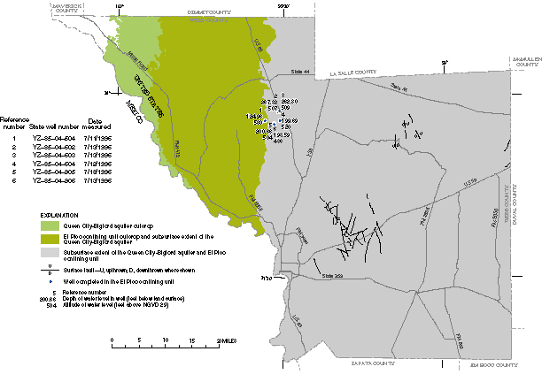
Figure 32. Extent of the Queen City-Bigford aquifer and El Pico confining unit outcrops, subsurface extent of the Queen City-Bigford aquifer and El Pico confining unit, and depth of water level in wells completed in the El Pico confining unit, 1996.
Back to Contents | Back to Text | Figure 33