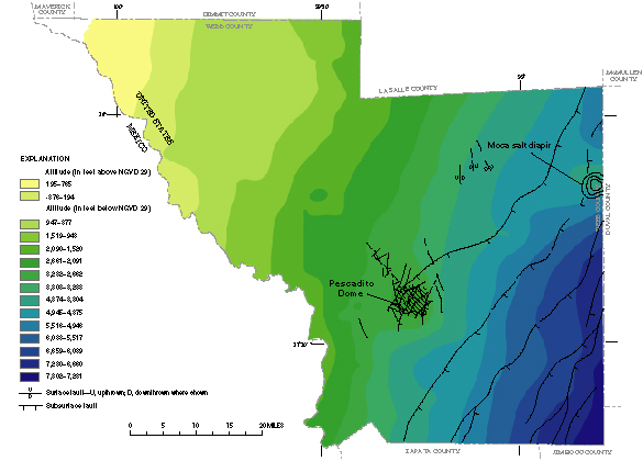
Figure 41.
Altitude of the top of the Carrizo aquifer.
Back to Contents
|
Back to Text
|
Figure 42