 |
|
|
||||
| Oregon Water Science Center |
Estimation of Peak Discharges for Rural, Unregulated Streams in Western Oregon |
By Richard M. Cooper (Oregon Water Resources Department) |
Scientific Investigations Report 2005-5116 |
Prepared in cooperation with the Oregon Water Resources Department |
| Download the report |
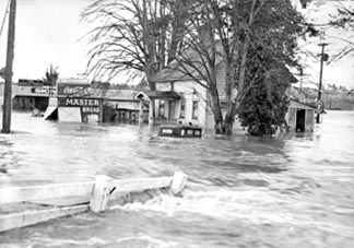
AbstractMethods for estimating the magnitudes of peak discharges at various frequencies were developed for unregulated rural streams in western Oregon. Development of these methods had two parts: (1) fitting observed peak discharges to a theoretical probability distribution and (2) developing equations to predict the magnitude of peak discharges at various frequencies. In the first part, logarithms of annual peak discharges were fitted to the Pearson Type III probability distribution for each of 376 gaging stations in the study area. For each gaging station, based on its fitted probability distribution, estimates were made of the magnitudes of the peak discharges for recurrence intervals of 2, 5, 10, 25, 50, 100, and 500 years. All annual series of peak discharges used in this analysis were from unregulated rural streams. In fitting the probability distributions, estimates of station skew were improved by adjustment with a “generalized” skew value based on the skews for long-term stations in the area. The areal distribution of the generalized logarithmic skew coefficients of annual peak discharge for Oregon was determined using geographic information systems (GIS) techniques. The actual areal distribution is a GIS grid but is represented in this report as an isoline map. In practice, generalized logarithmic skew coefficients are determined from the grid, not the isoline map. Western Oregon was divided into three “flood regions.” For each region, prediction equations were developed for estimating peak discharges at ungaged sites for the selected recurrence intervals. The equations relate peak discharge to physical and climatologic watershed characteristics such as drainage area and precipitation intensity. The equations were derived by generalized least-squares regression using data for the 376 gaged watersheds. Average standard error of prediction for the equations ranged from 25.3 to 39.1 percent. The accuracy of the equations and limitations on their use are discussed. Use of the prediction equations in various circumstances is illustrated with examples. Use of the prediction equations requires estimates of watershed characteristics. Because of the reliance in this analysis on GIS techniques, making appropriate and reliable estimates of watershed characteristics may be inconvenient for many users. To make the prediction equations as widely available as possible, the Oregon Water Resources Department has developed an interactive Web site utility to facilitate the use of the equations: http://www.wrd.state.or.us/OWRD/SW/peak_flow.shtml. |
||||
|
Download the entire report (PDF, 11 MB) (Adobe Reader® required; version 5 or higher preferred. If you do not have the Adobe PDF Reader, it is available for free download from Adobe Systems Incorporated.) Parts of the report may be downloaded as individual PDF files (below) The approximate size of a file is given after the first section in that file. ContentsAbstract (1.4 MB) If you do not have a broadband (fast) Internet connection, the larger PDF files will take a long time to download. You can request a printed version of the report by clicking on this link. |
||||
|
Document Accessibility: Adobe Systems Incorporated has information about PDFs and the visually impaired. This information provides tools to help make PDF files accessible. These tools convert Adobe PDF documents into HTML or ASCII text, which then can be read by screen-reading programs that synthesize text as audible speech. In addition, a version of Adobe Reader that contains support for screen readers is available. The conversion tools and the accessible reader may be obtained free from Adobe through their conversion tools Web site. For information on ordering Oregon Water Science Center publications, click on this link. To learn more about USGS activities in Oregon, please visit our home page.
| ||||