Use of Sediment Rating Curves and Optical Backscatter Data to Characterize Sediment Transport in the Upper Yuba River Watershed, California, 2001–03
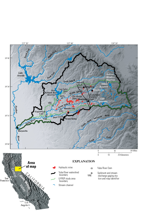
By Jennifer A. Curtis1, Lorraine E. Flint1, Charles N. Alpers1, Scott A. Wright2 and Noah P. Snyder3
U.S. Geological Survey Scientific Investigations Report  2005–5246 , published 2006.
Figure 1
Location of sediment and streamflow gaging stations, study area of the Upper Yuba River Studies Program (UYRSP), and the upper Yuba River watershed, California.
See table 1 for station names.
Figure 1 - Location of sediment and streamflow gaging stations, study area of the Upper Yuba River Studies Program (UYRSP), and the upper Yuba River watershed, California.