Use of Sediment Rating Curves and Optical Backscatter Data to Characterize Sediment Transport in the Upper Yuba River Watershed, California, 2001–03
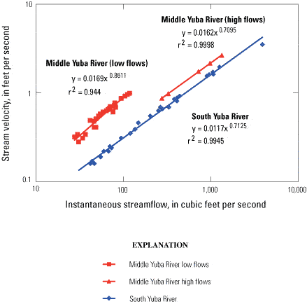
Figure 8
Mean velocity and streamflow relations for gaging stations on the Middle Yuba River (11410000) and South Yuba River (11417500) in the upper Yuba River watershed, California.
Note that streamflow measurements were collected at two sites near the Middle Yuba River gaging station: a wading site during low flows and at a bridge site during higher flows.