Use of Sediment Rating Curves and Optical Backscatter Data to Characterize Sediment Transport in the Upper Yuba River Watershed, California, 2001–03
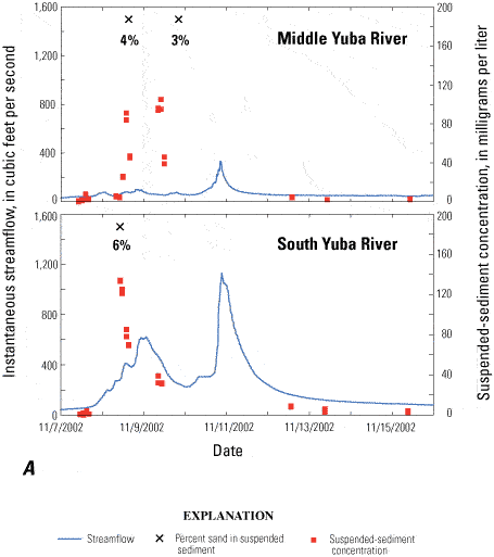
Figure 9A
Instantaneous streamflow, suspended-sediment concentrations, and percent sand of suspended sediment during storm events at the Middle Yuba River (11410000) and South Yuba River (11417500) gaging stations in the upper Yuba River watershed, California, November 2002.
X's denote the date and time of samples analyzed for percent sand, and there are no grain-size data from the February 2003 event at Middle Yuba River gage.

