 Abstract
The Leary Weber Ditch Basin is nested within the Sugar Creek Basin in
central Indiana. These basins make up one of the five study sites in the
Nation selected for the Agricultural Chemicals: Sources, Transport, and Fate
topical study, a part of the U.S. Geological Survey’s National Water-Quality
Assessment Program. In this topical study, identifying the natural factors
and human influences affecting water quality in the Leary Weber Ditch and
Sugar Creek Basins are the focus of the assessment. A detailed comparison
between the environmental settings of these basins is presented. Specifics
of the topical study design as implemented in the Leary Weber Ditch and
Sugar Creek Basins are described.
The Leary Weber Ditch and Sugar Creek Basins have moderate temperatures
with well-defined winter and summer seasons. The mean annual precipitation
is 39.5 inches, with the majority of rainfall in spring and early summer and
the lowest amount of precipitation in winter. Yearly, an average of 25
inches of moisture moves into the atmosphere as a result of
evapotranspiration.
Physiographically, both basins are contained completely within the New
Castle Till Plains and Drainageways. The gradients of the valleys of Leary
Weber Ditch and Sugar Creek differ substantially. Most of the Sugar Creek
Basin and the entire Leary Weber Ditch Basin overlie a combination of
Devonian limestone and dolomite bedrock. Unconsolidated materials (sand and
gravel) overlie much of the bedrock in the basins. Soils are either loam or
silt loam, generally deep, poorly drained, medium textured, and nearly
level. The potential for surface erosion is negligible because runoff is
slow. Available water capacity is high. Natural fertility and organic matter
are moderate. Soils are naturally suited to row crops.
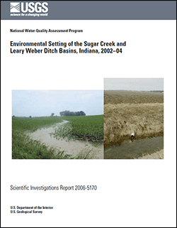
Agriculture is the principal land use in the Leary Weber Ditch and Sugar
Creek Basins. Respectively, 87 percent and 75 percent of the total land area
in these basins are used for row crops. The cropped areas within the basins
are divided nearly equally between corn and soybeans. Farming practices in
the area employ a wide range of tools to promote growth and inhibit
vegetative competition; these include the use of fertilizers, herbicides,
and pesticides. Tile drains are used extensively to improve yields and make
the soils farmable. Irrigation and manure application in the study area are
minimal.
Most of the study area is in Hancock County, Indiana. The county
population is approximately 61,000. There are no large cities in either
basin; most residents live in small communities or rural areas. Water use in
Hancock County totalled 6.37 million gallons per day during 2002. Drinking
water comes entirely from ground water.
The U.S. Geological Survey operates streamflow-gaging stations at Sugar
Creek at New Palestine and at Leary Weber Ditch at Mohawk within the study
area. Mean daily streamflow for Sugar Creek is higher than streamflow at
Leary Weber Ditch. Through most of its length, Sugar Creek is a gaining
stream and base flow is supported by ground-water sources. At Leary Weber
Ditch, there is little to no streamflow when tile drains are dry.
Modifications to the natural hydrology of the study area include a large
system of tile drains, the intersection of Sugar Creek by several major
roads, and outflows from nearby wastewater-treatment plants. Leary Weber
Ditch is affected only by tile drains.

