Arizona Water Science Center
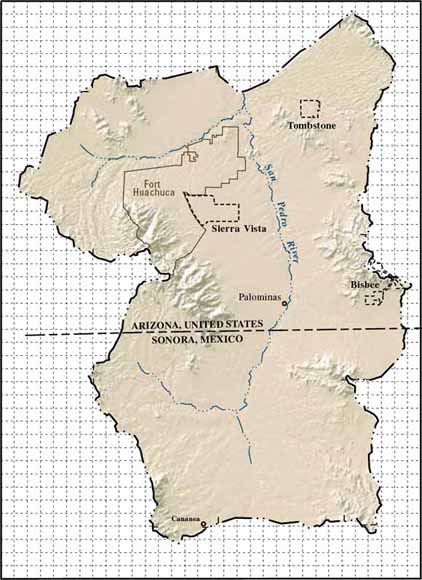
A numerical ground-water model was developed to simulate seasonal and long-term variations in ground-water flow in the Sierra Vista subwatershed, Arizona, United States, and Sonora, Mexico, portions of the Upper San Pedro Basin. This model includes the simulation of details of the groundwater flow system that were not simulated by previous models, such as ground-water flow in the sedimentary rocks that surround and underlie the alluvial basin deposits, withdrawals for dewatering purposes at the Tombstone mine, discharge to springs in the Huachuca Mountains, thick low-permeability intervals of silt and clay that separate the ground-water flow system into deep-confined and shallow-unconfined systems, ephemeral-channel recharge, and seasonal variations in ground-water discharge by wells and evapotranspiration.
Steady-state and transient conditions during 1902-2003 were simulated by using a five-layer numerical ground- water flow model representing multiple hydrogeologic units. Hydraulic properties of model layers, streamflow, and evapotranspiration rates were estimated as part of the calibration process by using observed water levels, vertical hydraulic gradients, streamflow, and estimated evapotranspiration rates as constraints. Simulations approximate observed water-level trends throughout most of the model area and streamflow trends at the Charleston streamflow-gaging station on the San Pedro River. Differences in observed and simulated water levels, streamflow, and evapotranspiration could be reduced through simulation of climate-related variations in recharge rates and recharge from flood-flow infiltration.
Download the text for this report as a 60-page PDF file (sir2006-5228.pdf; 5.8 MB)
For questions about the content of this report, contact Donald Pool
Download the Suggested citation and version history
Download a current version of Adobe Reader for free
| Help
| PDF help
| Publications main page | Western Scientific Investigations Reports |
| Water Resources | Arizona Water Science Center
|
This report is available only on the Web

![]() U.S. Department of the Interior | U.S. Geological Survey
U.S. Department of the Interior | U.S. Geological Survey
URL: https://pubs.usgs.gov/sir/2006/5228/
Page Contact Information: Michael Diggles
Page Last Modified: October 15, 2007