Scientific Investigations Report 2006–5316
U.S. GEOLOGICAL SURVEY
Scientific Investigations Report 2006–5316
DOE/ID-22201
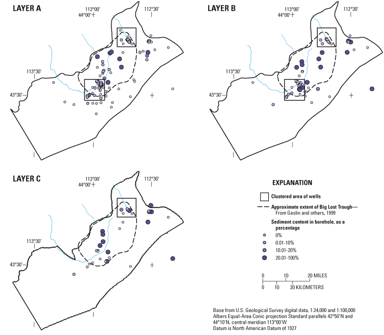
Figure 10. Availability of boreholes that fully penetrate each model layer and that were used to model the two-dimensional spatial abundance of sediment in each model layer. Boxes differentiate north- and south-clustered areas of wells used to evaluate spatial stationarity (see fig. 12).

![]() U.S.
Department of the Interior | U.S. Geological
Survey
U.S.
Department of the Interior | U.S. Geological
Survey
Persistent URL: https://pubs.water.usgs.gov/sir20065316
Page Contact Information: Publications Team
Page Last Modified: Thursday, 01-Dec-2016 19:32:57 EST
